Winnipeg & Southeastern Manitoba Under Tornado Threat Friday, but Storm Development is Questionable
/
NOTE: YOU CAN CLICK ON THE MAP TO OPEN A ZOOMABLE IMAGE
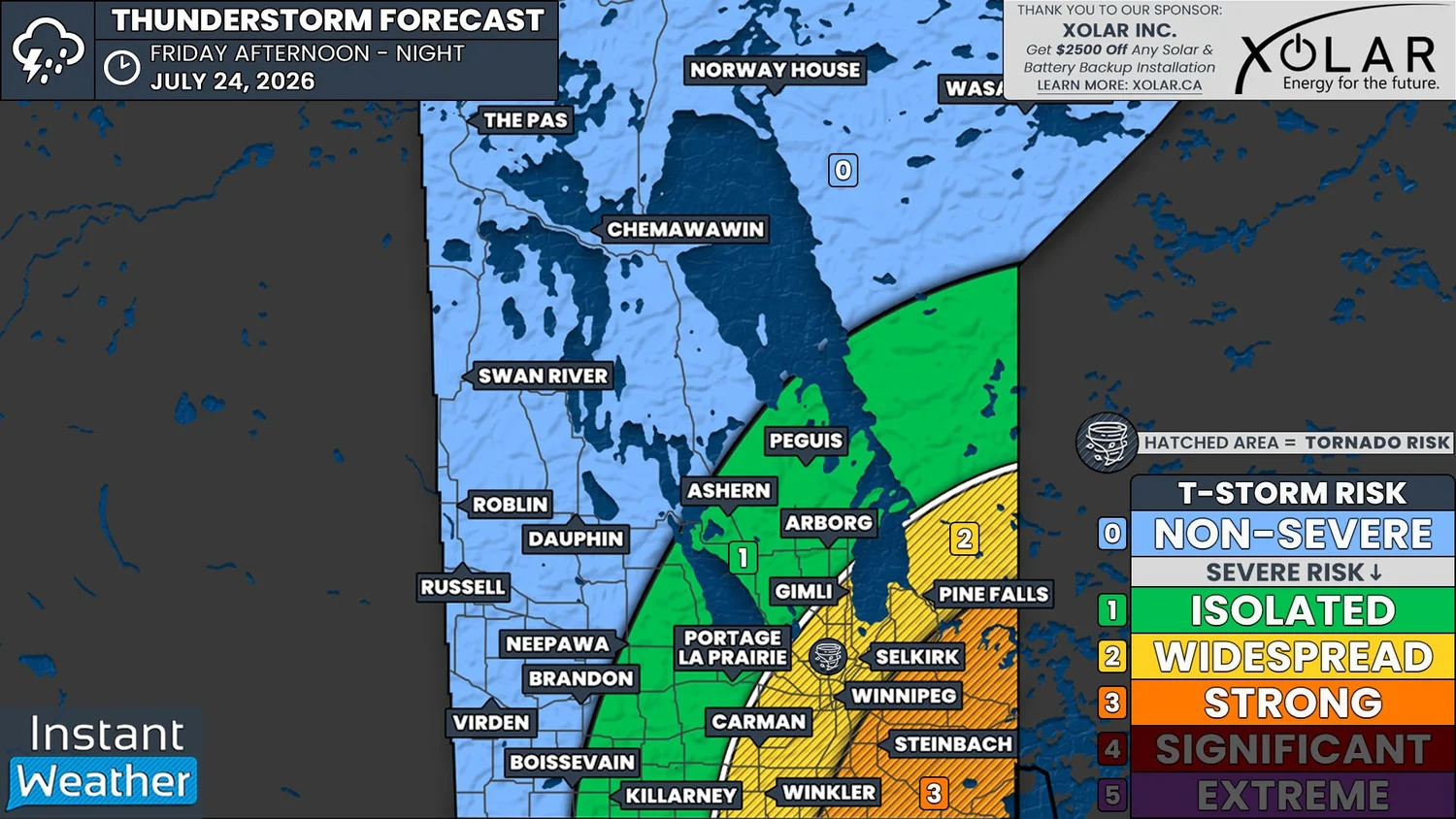
A strong severe weather risk returns to Southeastern Manitoba later today, but the entire situation is very questionable and there’s a possibility that there are no storms at all in this region.
The low that has been tracking across the Northern Prairies continues to make its way through Northern Manitoba this morning and it will move into Northern Ontario later today. Thunderstorms were triggered by a trough behind the warm front of this low in Northern Alberta and Saskatchewan yesterday and they extended into Southern Saskatchewan and into Manitoba overnight.
These storms are continuing across Southern Manitoba this morning, some of which have become severe, and this is where the first question mark for later development arises.
In order for additional thunderstorms to initiate later, this morning’s storms will have to clear out of the area early enough for sufficient surface heating to occur. If these storms do manage to exit the region early enough, the environment will be well suited for stronger severe thunderstorms to then begin to develop later this afternoon and into the evening.
The position of the trough that has been triggering thunderstorms will also play a large role in when and where more storms might initiate. In this morning’s latest runs, most short-term weather models are hinting at the trough being positioned in Northern Ontario by the time more thunderstorms fire up, which would keep the greatest severe threat to the east.
If everything manages to come together, with the morning storms clearing early and the trough remaining in Manitoba later this afternoon, there is a distinct possibility that some strong thunderstorms could impact Southeastern Manitoba through the evening. Storms that could affect this region will have potential to produce some very large hail, especially to the east of the Red River Valley. There will also be the risk of damaging wind gusts that could exceed 100km/h, torrential downpours and even a tornado.
While today’s severe weather risk could very easily end up being a bust, it’ll be a good idea to be prepared in the event that strong thunderstorms do end up forming. Make sure to have your devices all charged and that you have multiple ways to receive weather alerts and updates.
If the severe risk manages to materialize in Manitoba later on, we will very likely be live-streaming coverage of the storms, so be sure to join us at www.instantweather.ca/live!