Wildfire Smoke Could Hinder Severe Thunderstorm and Tornado Threat for Edmonton and Parts of Central & Northern Alberta Saturday
/
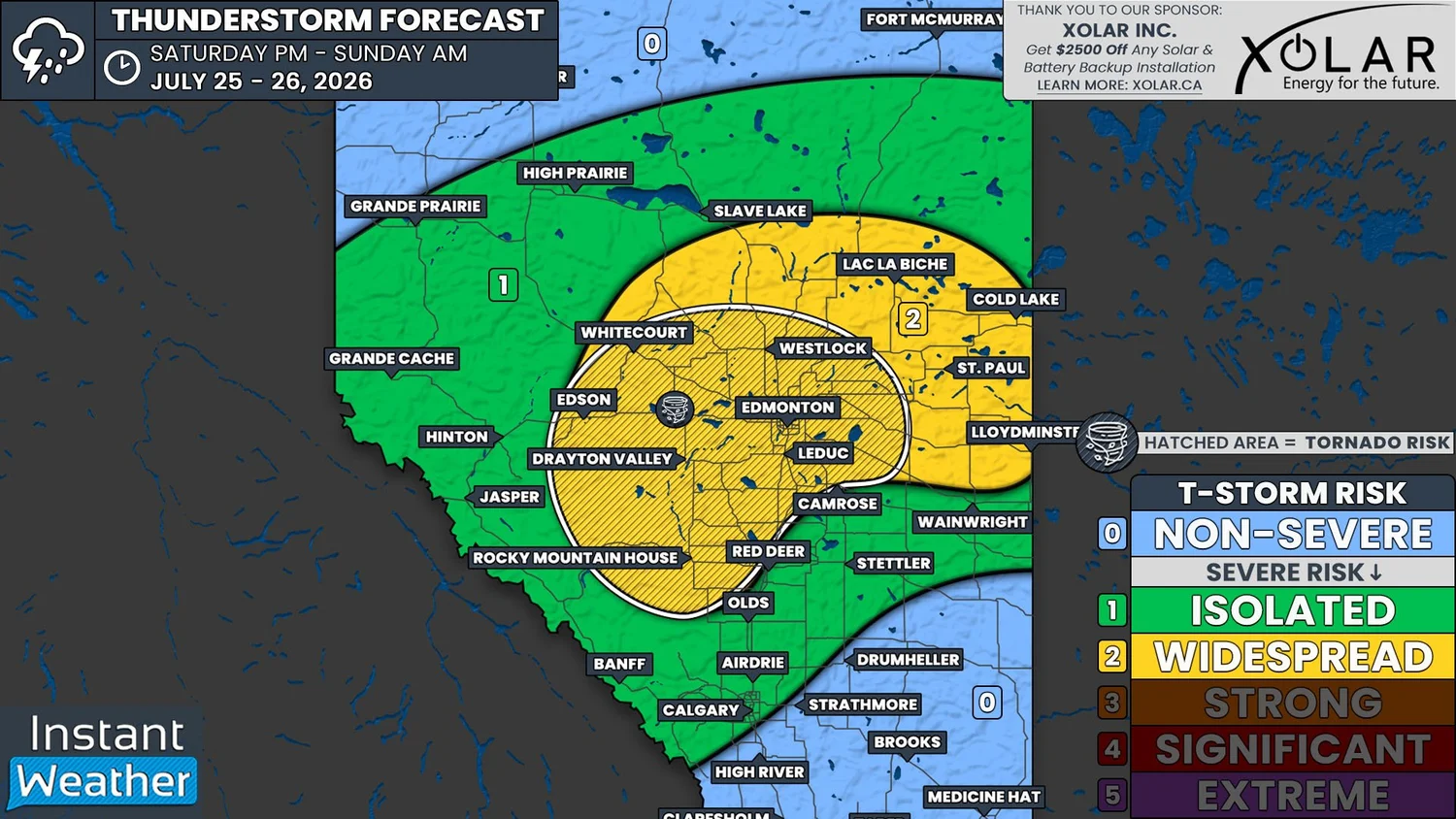
NOTE: YOU CAN CLICK ON THE MAP TO OPEN A ZOOMABLE IMAGE
The risk for severe weather returns to Edmonton and parts of Central and Northern Alberta with the possibility of severe thunderstorms across the region beginning this afternoon and continuing into the overnight hours.
In yesterday’s thunderstorm outlook from Environment Canada, they had a High Risk for this region. That High Risk has since been downgraded to a Moderate Risk, likely due to the impact that wildfire smoke will have on the potential development of thunderstorms later today.
Smoke from wildfires in British Columbia and the US Pacific Northwest has been significantly impacting air quality at ground level across Alberta over the past few days. However, the presence of smoke higher up in the atmosphere can greatly influence our weather conditions.
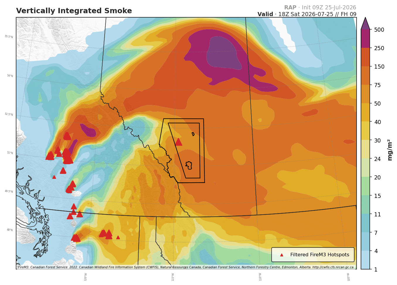
Modelled Vertically Integrated Smoke at of 12pm MDT, Courtesy of WMI.
When we have thick smoke throughout the atmosphere, not as much sunlight is able to reach the ground and as a result, it end ups being a few degrees cooler at the surface than expected. A decrease in surface heating while the air aloft is able to heat up also greatly reduces the instability and creates a capping inversion that could block thunderstorm development.
Despite the smoke, there is still a chance that we could see some severe thunderstorms fire up today, but it is not a guarantee. Models are showing that a decent amount of instability could still be available, along with plenty of moisture and shear, to fuel thunderstorms if they are able to break through the cap.
Thunderstorm activity could initiate early this afternoon, particularly in the Foothills, and storms that develop are expected to gradually track northeastward through the remainder of the afternoon and into the evening and overnight hours, with additional storms possibly popping up through this period.
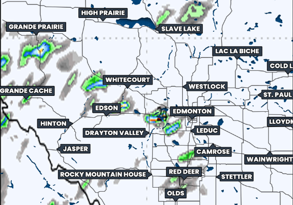
Hourly Precipitation at 5Pm MDt, courtesy of weatherbell.
The storms that may end up forming today will have the potential to become severe across parts of Central and Northern Alberta, in the area in yellow on our forecast map. In this region, the storms may be able to produce large hail up to the size of tennis balls, damaging wind gusts above 100km/h, and heavy rain. The hatched area on the map, which includes Edmonton, Red Deer, Rocky Mountain House, and Edson, will also have an isolated tornado risk.
Today’s severe weather risk could end up being a bust as a result of the wildfire smoke. However, with Edmonton potentially in the bullseye with a tornado risk, we will certainly be keeping a close on how things come together this afternoon.