First Accumulating Snowfall of the Season Could Impact Many Albertans' Thanksgiving Weekend Plans
/
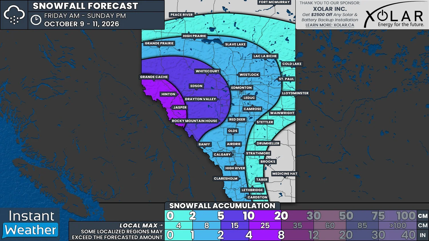
NOTE: YOU CAN CLICK ON THE MAP TO OPEN A ZOOMABLE IMAGE
Thanksgiving is this weekend and despite the lovely warmth across most of Alberta that has led to daily high temperatures into the teens and low 20s, we are in for a major cool down that will also be met with the first accumulation of snow for much of the province.
While this seems early, it’s actually just a tad bit later than usually for some areas to only now be seeing their first snow of the season, which typically occurs in the final week of September or first week of October.
A strong low pressure system has already begun to impact much of Northern Alberta and into parts of Central Alberta with widespread rain. This rain will continue into tomorrow morning, at which point we’ll start to see some transitioning over to snow as cold Arctic air makes its way southward.
This switch over from rain to snow will gradually expand throughout the day and is expected to mostly impact the southern portions of Northern Alberta and into the Northern Rockies and Foothills by the late evening and into overnight hours.
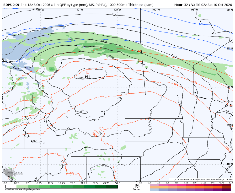
The rdps model showing precipitation type and intensity at 8pm on Friday, courtesy of WeatherBell.
As we move into early Saturday morning, most of the rain is expected to have changed to snow and it will spread southward through Central Alberta, along with temperatures approaching the freezing mark.
The area of snowfall will likely shrink starting late Saturday morning and through the afternoon as it continues tracking to the south. This will lead to little to no snow falling in the Southeast, while those in the Southwest could see a few centimetres.
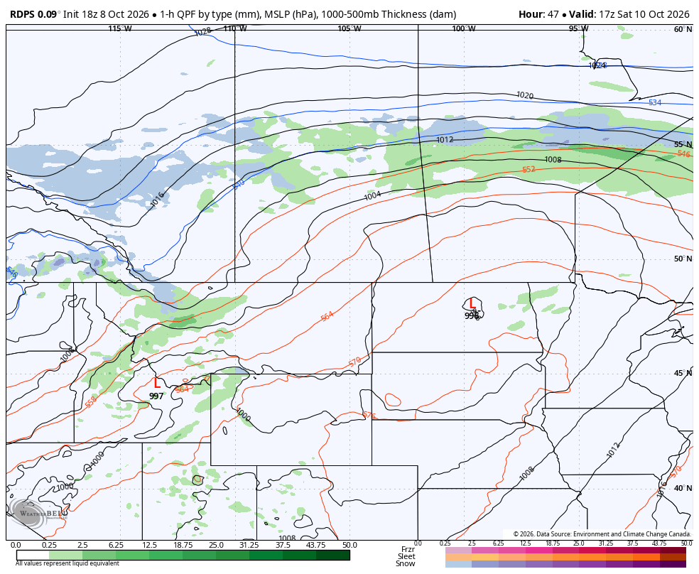
The rdps model showing precipitation type and intensity at 11am on Saturday, courtesy of WeatherBell.
The snow will continue to dissipate into Saturday evening and pockets of light snow are expected to persist overnight and into Sunday morning in West Central and Southwestern Alberta.
This could be joined by an additional area of snowfall that would be making its way into the Southwestern Alberta from Montana Sunday morning, which could stick around throughout the day before the snow finally comes to an end in the evening.
It’s important to keep in mind that the first couple of snowfall events of the season can be particularly tough to forecast and come with a great deal of uncertainty. This will be the case for this weekend, especially with double-digit temperatures that have been leading up to the major cool down over the next couple of days.
Of course, the snow will melt on contact with the warm ground at first, but as more and more snow falls, it becomes more likely that accumulation will occur. The key will be if and when the snow does begin to stick, and how much snow will be left to fall after that point.
The steady snowfall in the Northern Rockies, including in Grande Cache, Hinton, and Jasper National Park, is expected to result in 10-20cm of accumulation, with greater amounts possible at higher elevations. Extending east and southeastward from this region, lesser amounts of snow could still build up, particularly in the Foothills.
The greatest uncertainty lies within towns and cities, where warm pavement will likely melt the majority of the snow. Still, there is the possibility of upwards of 5cm of wet snow sticking to the ground in both Edmonton and Calgary.
With this being the Thanksgiving weekend, many people will have plans to travel to spend time with their loved ones. Please give yourself extra time to get to your destinations this weekend and use extra caution on any snow-covered roads. With how pleasant the weather has been lately, it’s unlikely that many motorists have even considered putting on their winter tires.
The good news is that it is going to warm up again next week so any accumulated snow won’t last for long!