Widespread Strong Severe Thunderstorm Risk Across the Prairies Sunday with Tornado Threat in Southwestern Manitoba
/
NOTE: YOU CAN CLICK ON THE MAP TO OPEN A ZOOMABLE IMAGE
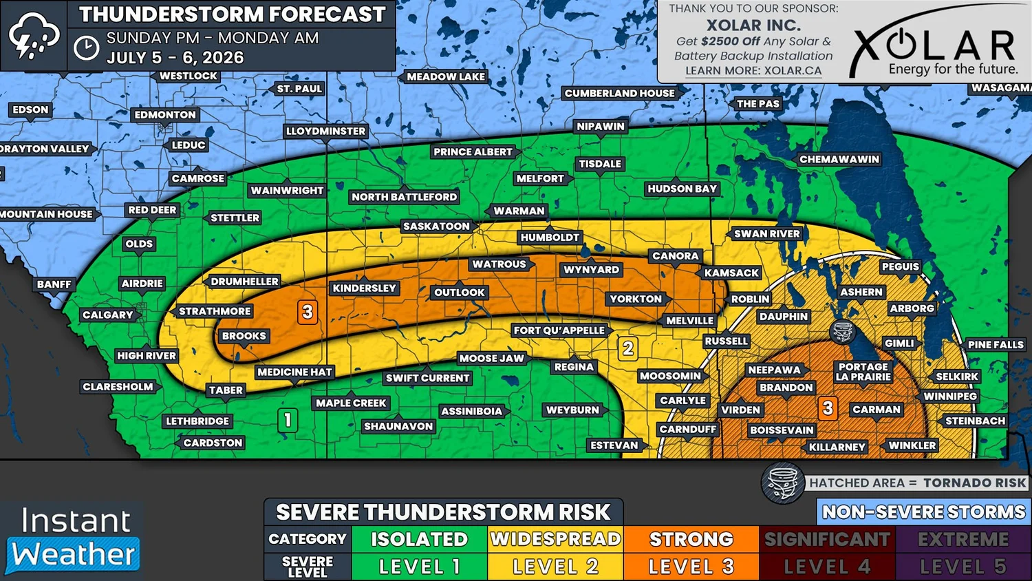
It’s another day with the possibility of severe weather across the Prairies. Today’s risk extends eastward from Southern Alberta through Central Saskatchewan and throughout most of Central and Southern Manitoba.
There are going to be two areas where we will be watching for thunderstorm development later today. The first being in Southern Alberta and the second in Southeastern Saskatchewan and Southwestern Manitoba.
Starting in Alberta, the combination of heat and moisture from the south, along with considerable instability, will create the ideal environment for severe thunderstorms to develop this afternoon. The storms are expected to be supercells or multicellular that would develop in the Southern Foothills.
As the storms track eastward beyond the Foothills, they should become severe and possibly long-tracked thunderstorms. Looking at weather models, it appears as though things will strengthen to the east of Calgary, but there will still be an isolated severe risk for the City and the crowds at the Stampede.
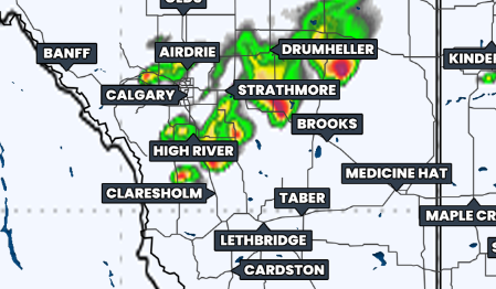
Simulated reflectivity at 6pm MDT, courtesy of weatherbell.
The thunderstorms that develop in Southern Alberta this afternoon could very well maintain their strength and continue tracking eastward straight across Central Saskatchewan through the late evening and into the overnight hours. There is a bit of a question mark with this, with some models showing this possibility while others show nothing impacting Saskatchewan.
Regardless, the thunderstorms that do end up developing in this region could be quite strong and have the potential to create very large hail that could possibly be as big as tennis balls, as well as damaging wind gusts in excess of 100km/h.
The secondary area of severe threat for today will exist in Southeastern Saskatchewan and across much of Southern and Central Manitoba.
The development of storms in this region will be courtesy of a cold front from a low pressure system that will move into the region this afternoon. The environment in this area will already be primed with substantial instability (CAPE values upwards of 3000J/kg) and a significant amount of vertical shear so thunderstorms will likely be quite strong, especially in Southwestern Manitoba.
Thunderstorm development in this part of the Prairies could kick off later this afternoon/early evening in deep Southeastern Saskatchewan and Southwestern Manitoba. These storms could then intensify quickly as they track east-northeastward across Southern Manitoba throughout the evening and overnight.
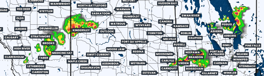
Simulated reflectivity at 9pm CDT, courtesy of weatherbell.
As with to the west, the severe thunderstorms that impact Southeastern Saskatchewan and Manitoba could also be quite strong. The entire region could experience large hail and damaging wind gusts, but in Southwestern Manitoba, where the strongest storms will likely hit, there could be hail as large as tennis balls. There is also the risk of tornado development throughout the evening that extends from Southeastern Saskatchewan to east of Winnipeg and northward into the Parkland and Interlake Regions.
We will be monitoring today’s thunderstorm development very closely and be sure to tune in later when we go live!