Strong Severe Thunderstorms Target Calgary and Surrounding Area Today with the Risk of Possibly Destructive Wind-Driven Hail
/
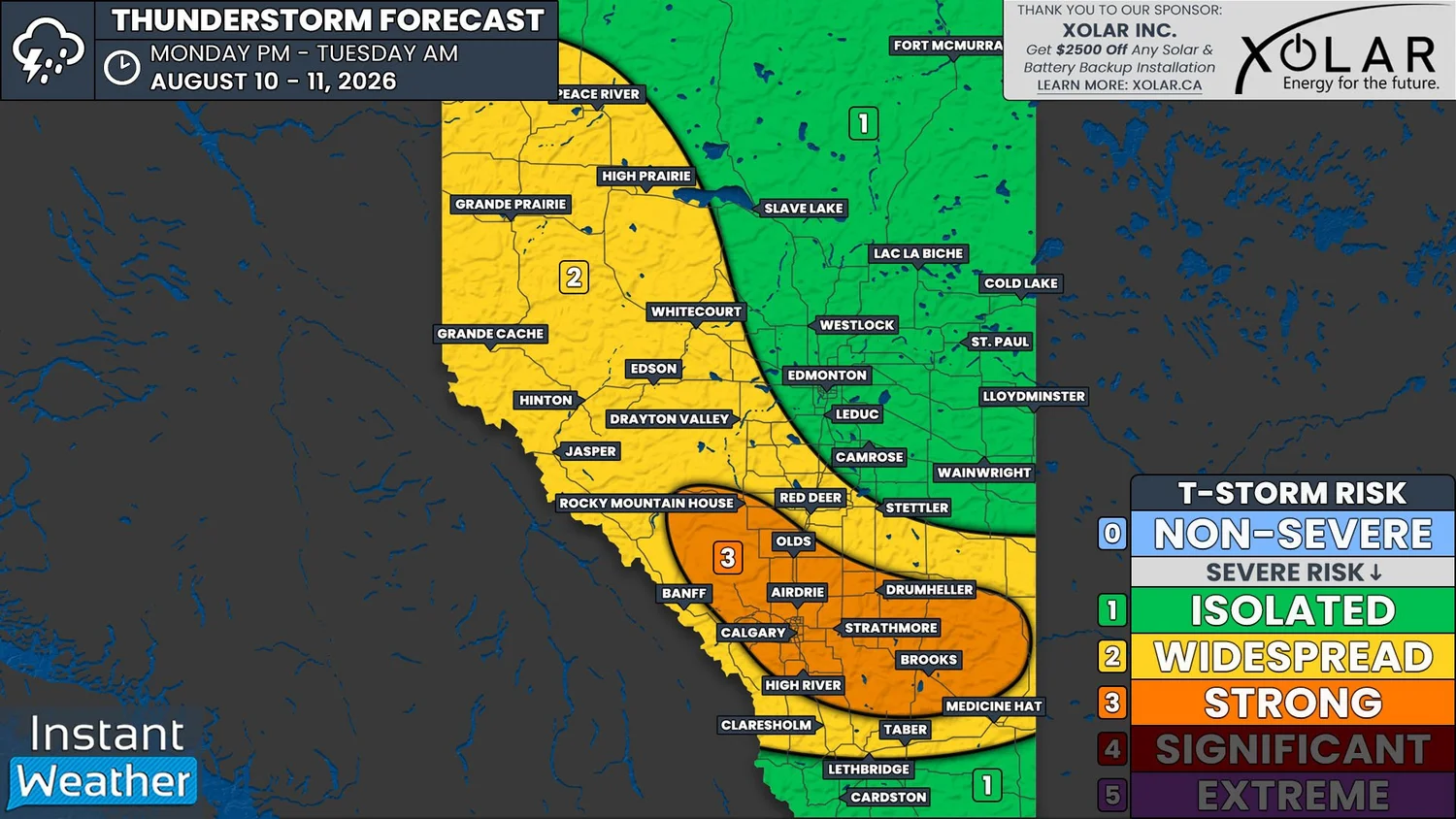
NOTE: YOU CAN CLICK ON THE MAP TO OPEN A ZOOMABLE IMAGE
Yesterday afternoon, we shared the Environment Canada thunderstorm outlook for today, which had a High Risk for severe weather today for parts of Central and Southern Alberta, including Calgary. That risk did not diminished overnight and we are still expecting to see some strong thunderstorms today.
We're already seeing some non-severe thunderstorms in parts of Central Alberta this morning. These storms should stay sub severe over the next few hours, but there is a slight chance that one could surpass the threshold of becoming severe.
More thunderstorms are expected to develop this afternoon, popping up across much of the province, some of which may persist into the overnight hours. As far as the Calgary area is concerned, it's likely that severe storms will develop to the northwest of the city in the mid-to-late afternoon, around 3-5pm, which could long-lived and track southeast towards the Saskatchewan border through to the late evening.
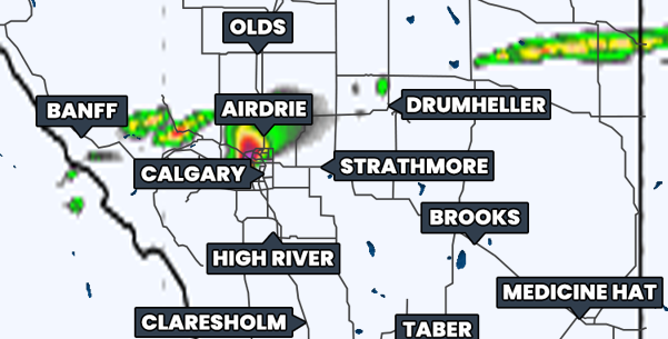
Simulated reflectivity from the hrrr model at 5pm MdT, courtesy of weatherbell.
At this point, there is still a bit of disagreement between models when it comes to what kind of thunderstorms could develop today and it's most likely that we will see a mixture of individual supercells in the south and multicellular clusters of thunderstorms in Central Alberta.
The multicellular clusters of storms are expected to mostly have a strong wind risk, along with the possibility of some fairly large hail. Meanwhile, the supercell storms will come with the greatest threat of large hail, which could be bigger than golf balls, as well as damaging winds well above 100km/h. This could particularly be the case for the storms that form to the northwest of Calgary and track into Southern Alberta.
As with any severe thunderstorms in the Prairies, especially with supercells, there will a tornado risk today, however it's looking like the greatest threat today will be large hail and damaging straight-line winds.
Today's setup is actually looking a little reminiscent of the destructive hail storm that tracked through parts of Calgary in August 2024, with the possibility of large hail that could be driven by very strong winds hitting the city. If you live in the area outlined in orange on our forecast map, especially if you're in Calgary, you may want to take precautions in the event that a similar destructive hail storm does end up forming.
We will certainly be going live today and we will be covering the severe thunderstorm and tornado risk in Southern Ontario, as well. Please be sure to join us later at instantweather.ca/live!