Southern Ontario: ‘Snow Day’ Forecast for Monday, December 1, 2025
/For an updated list of school bus cancellations & school closures, please visit our live article: https://instantweatherinc.com/article/2025/12/1/bus-cancellations

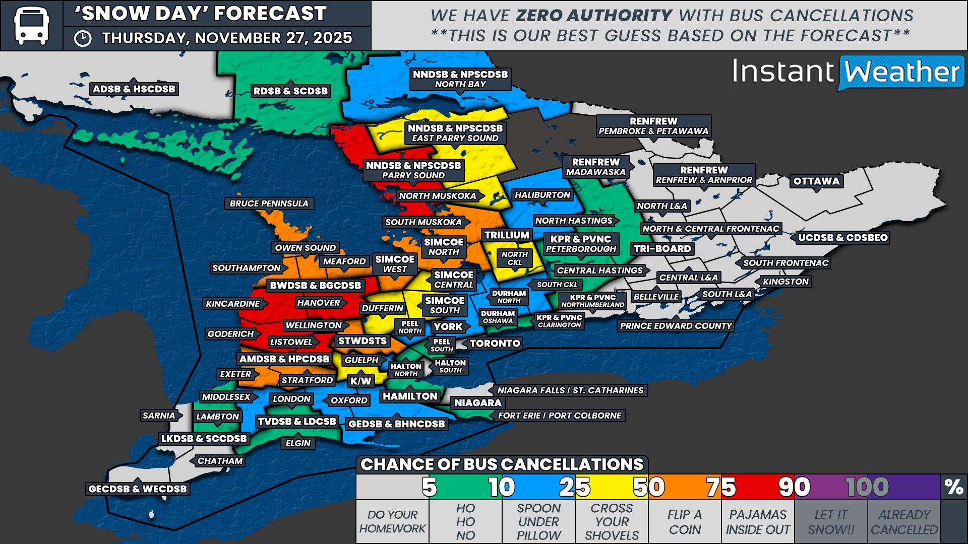
NOTE: YOU CAN CLICK ON THE MAP TO OPEN A ZOOMABLE IMAGE
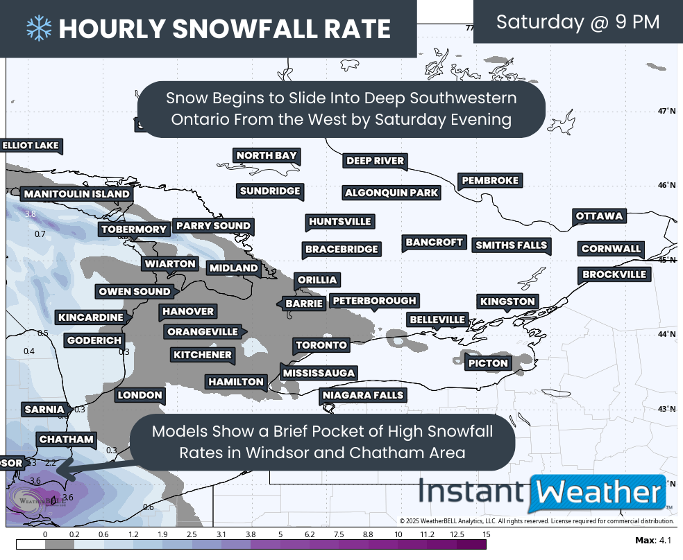
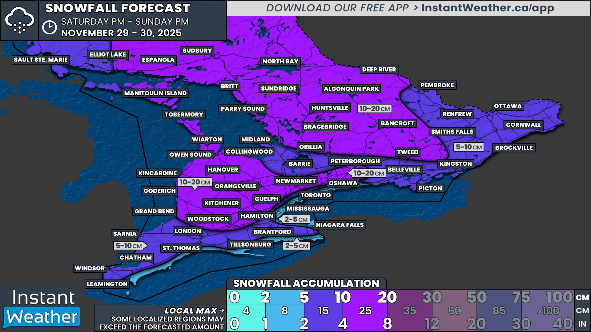
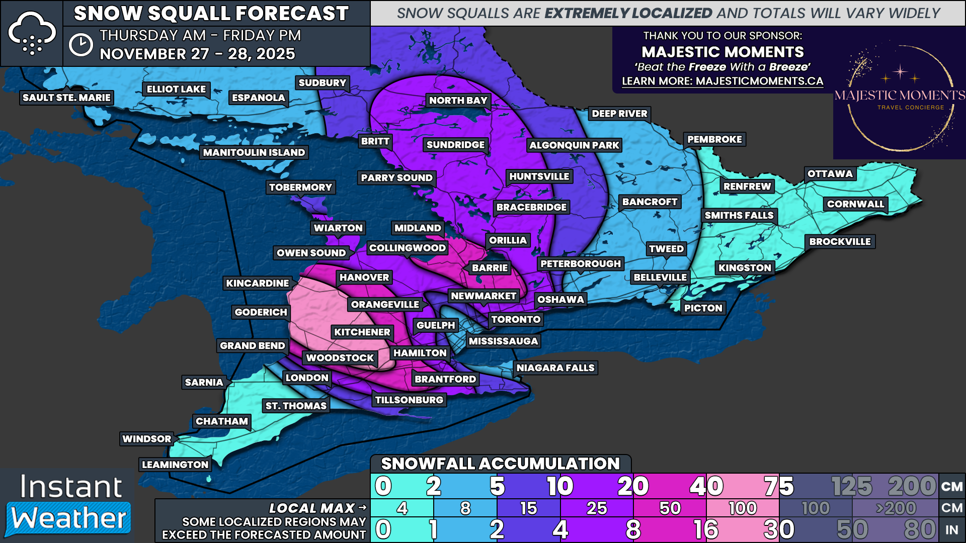
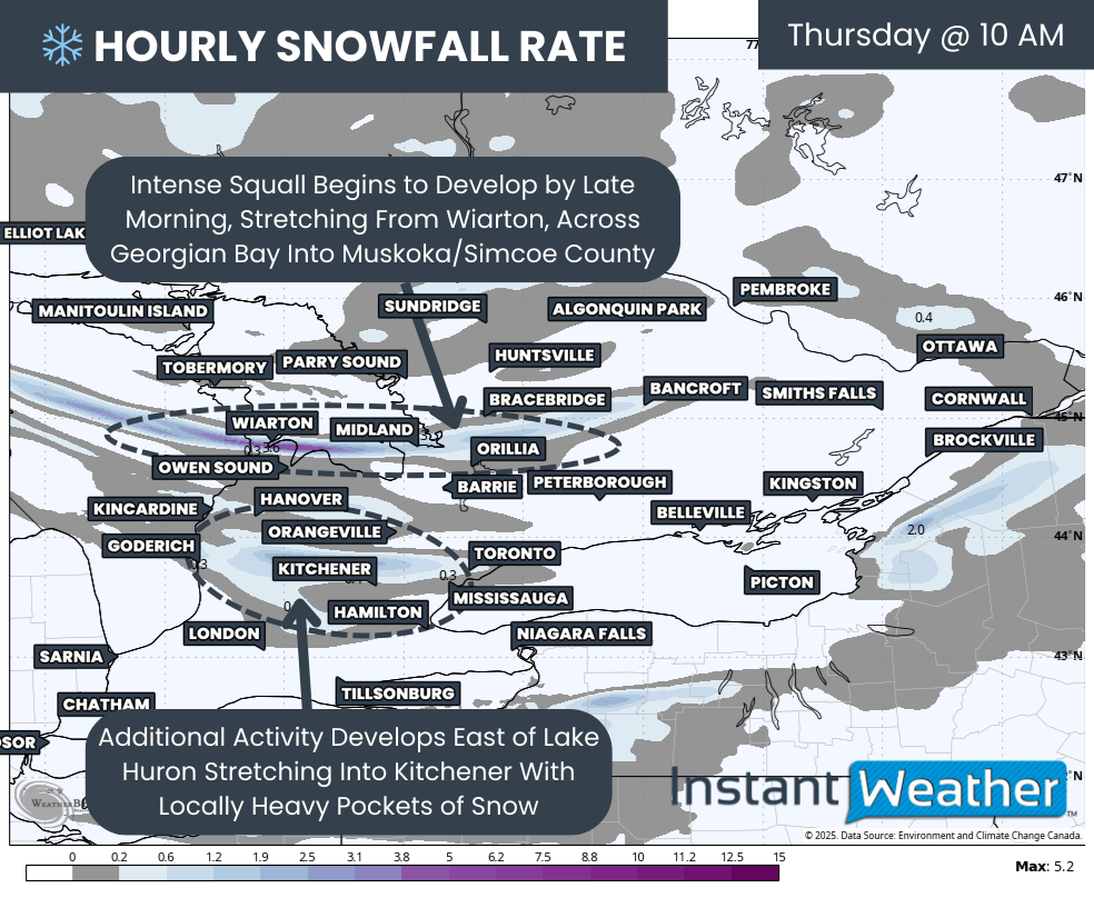
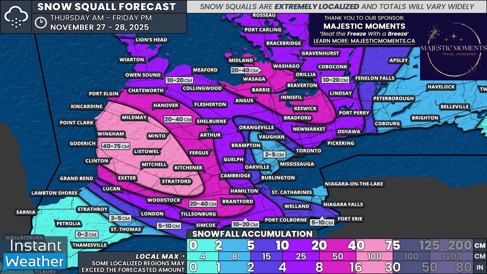
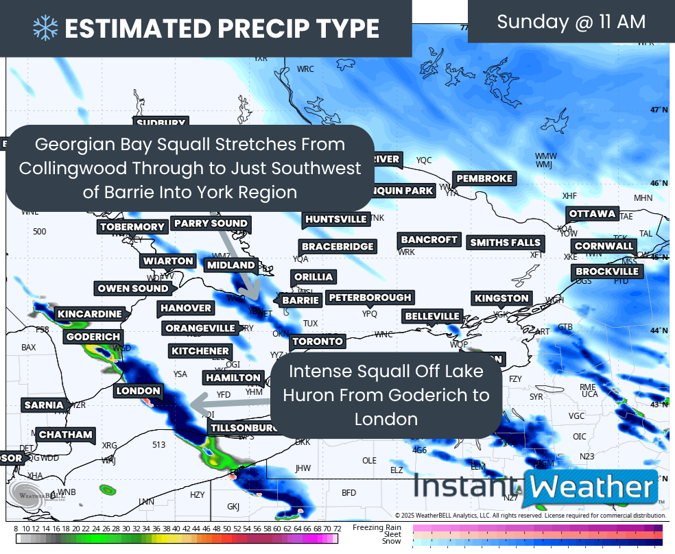
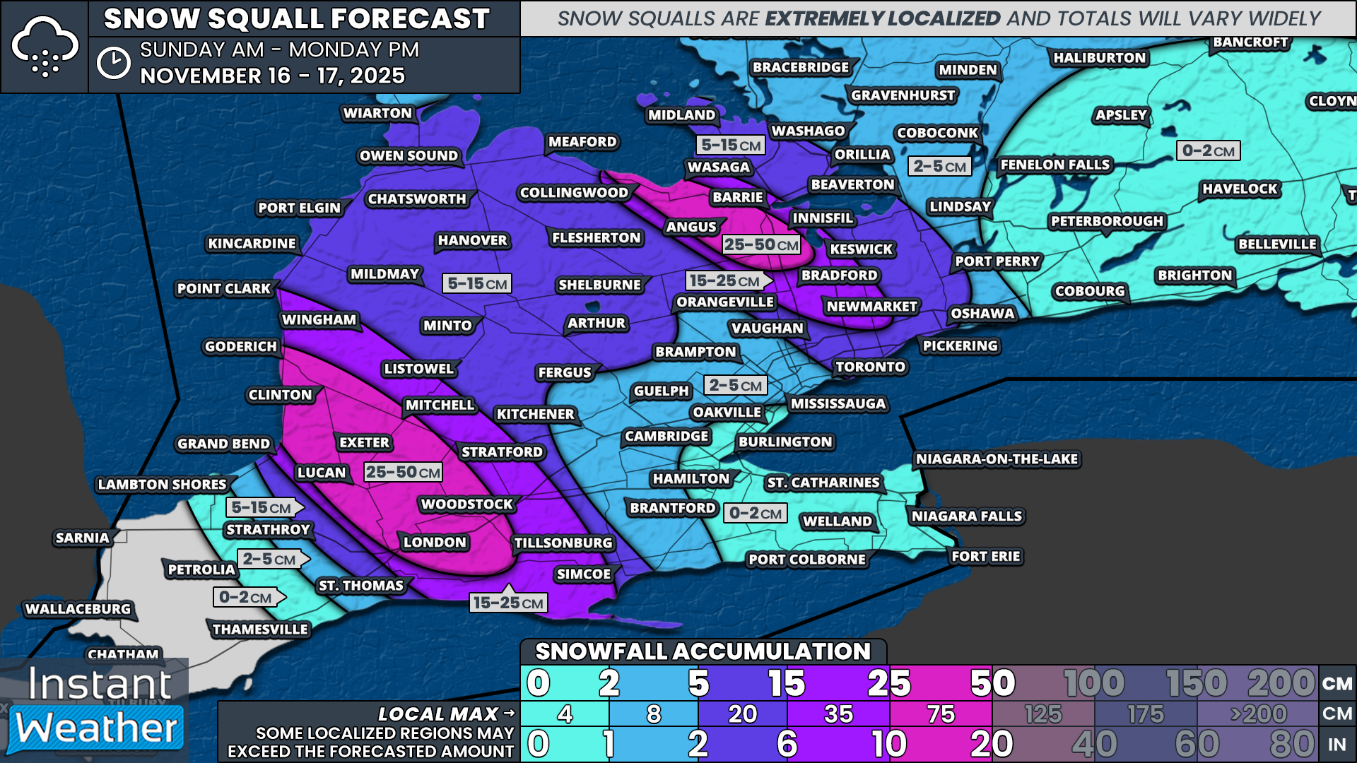
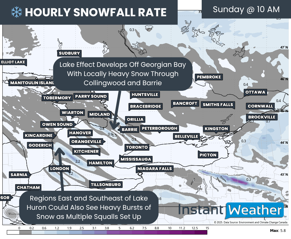
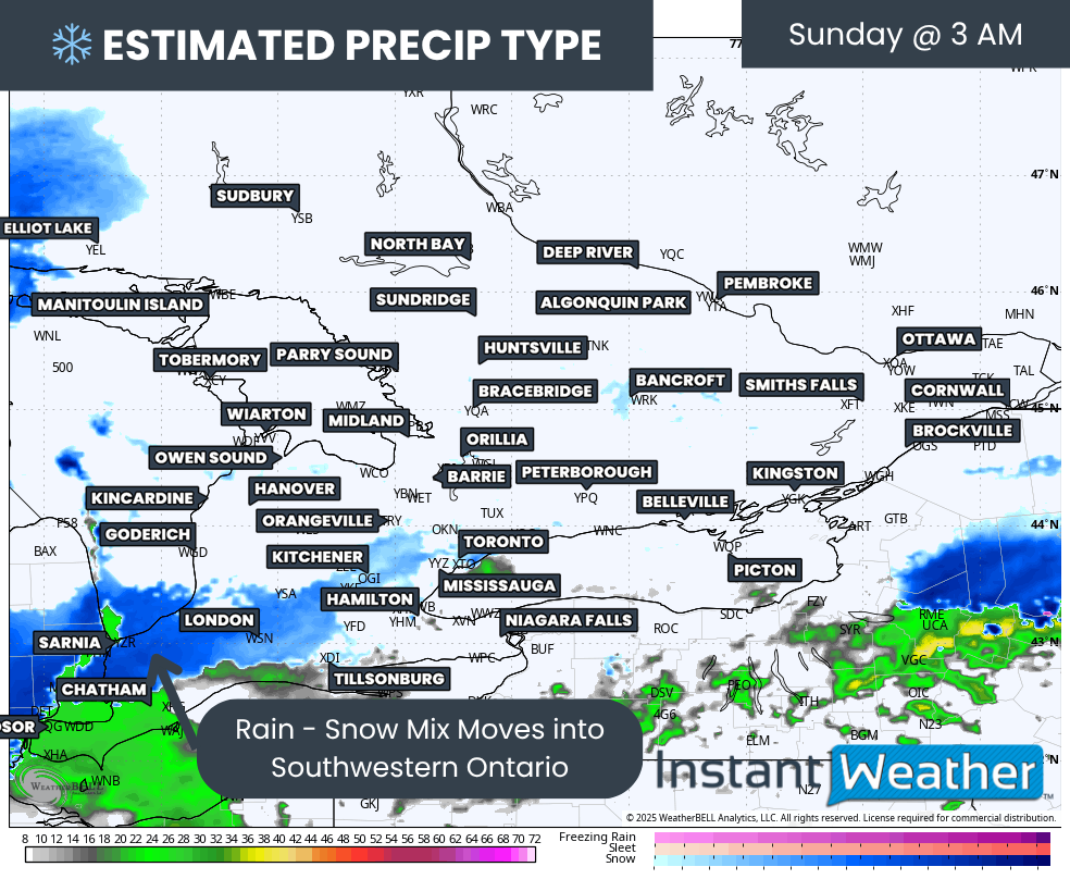
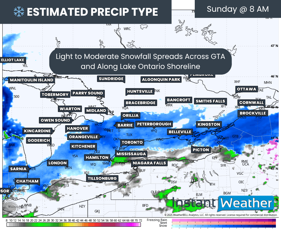
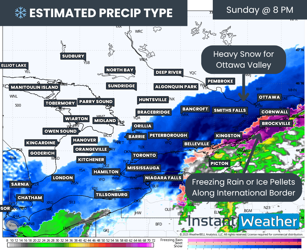
The system that brought widespread snowfall to Southern Ontario on Sunday has now begun to move out of the region. In its place, a sharp drop in temperatures has allowed lake effect snow to develop southeast of Lake Huron and Georgian Bay.
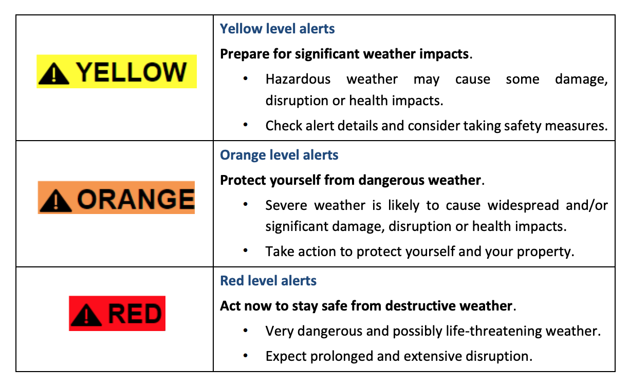
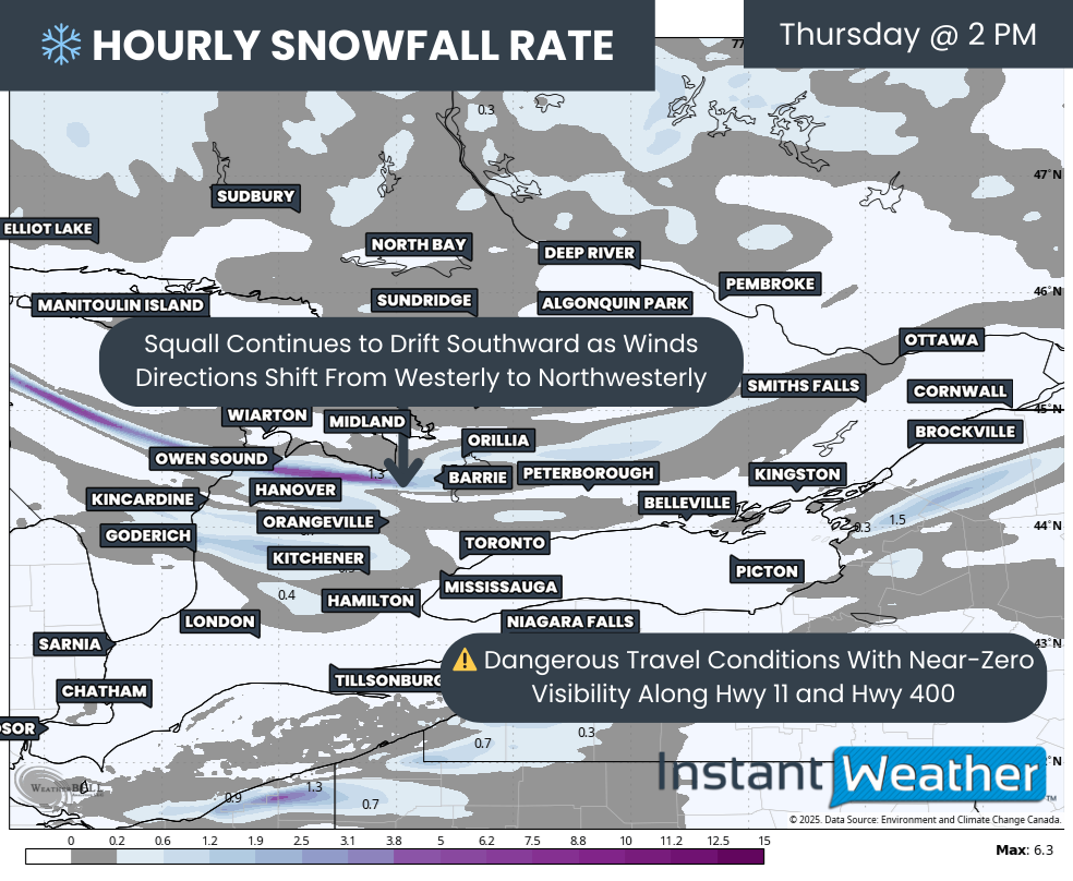
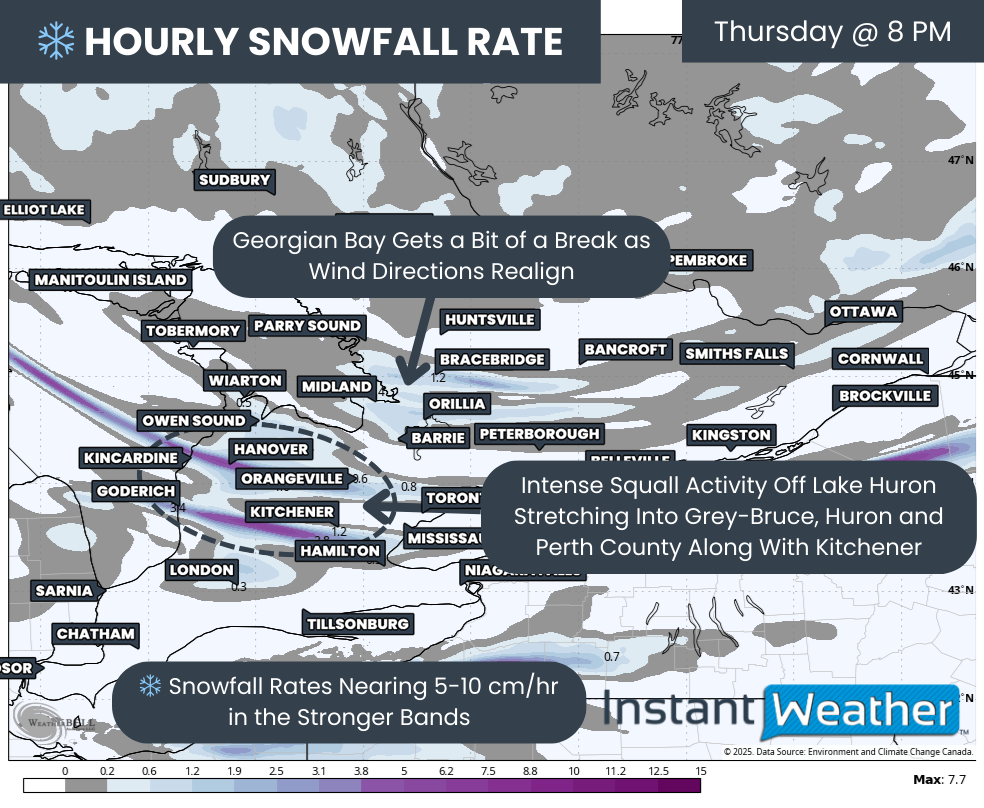
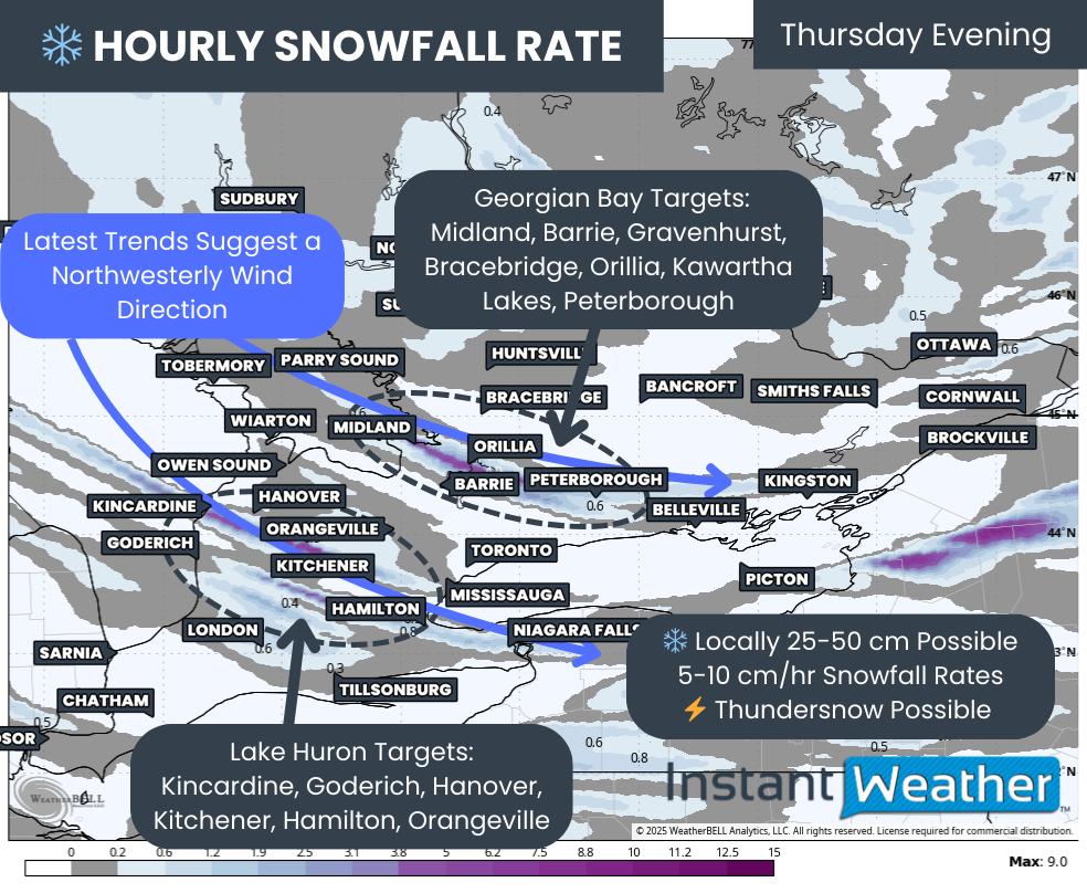
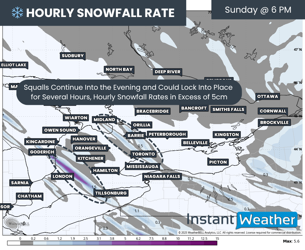
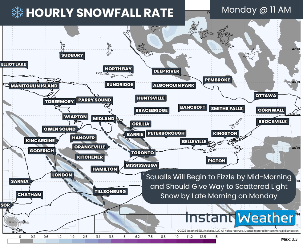
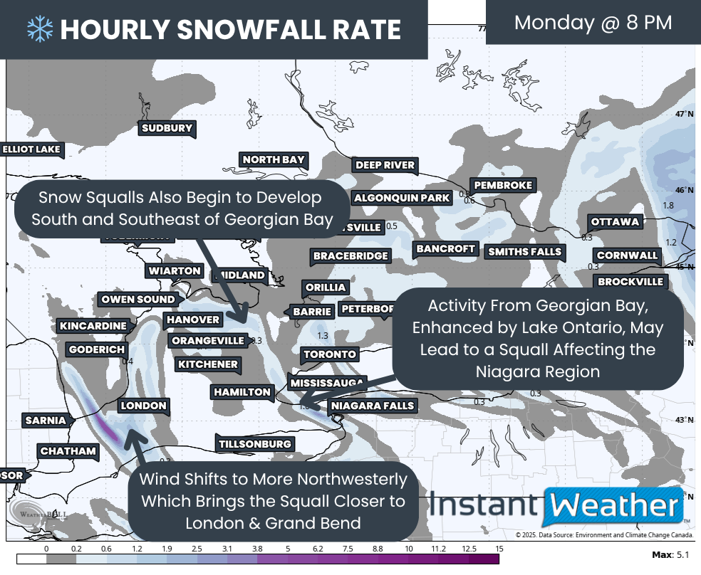
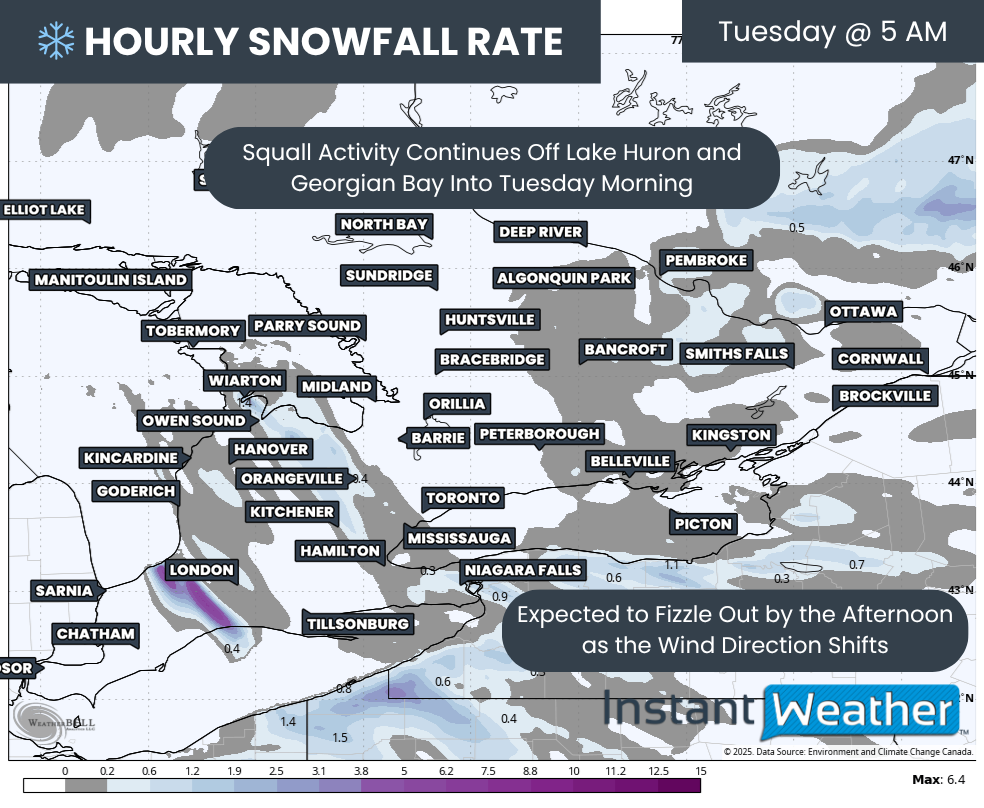
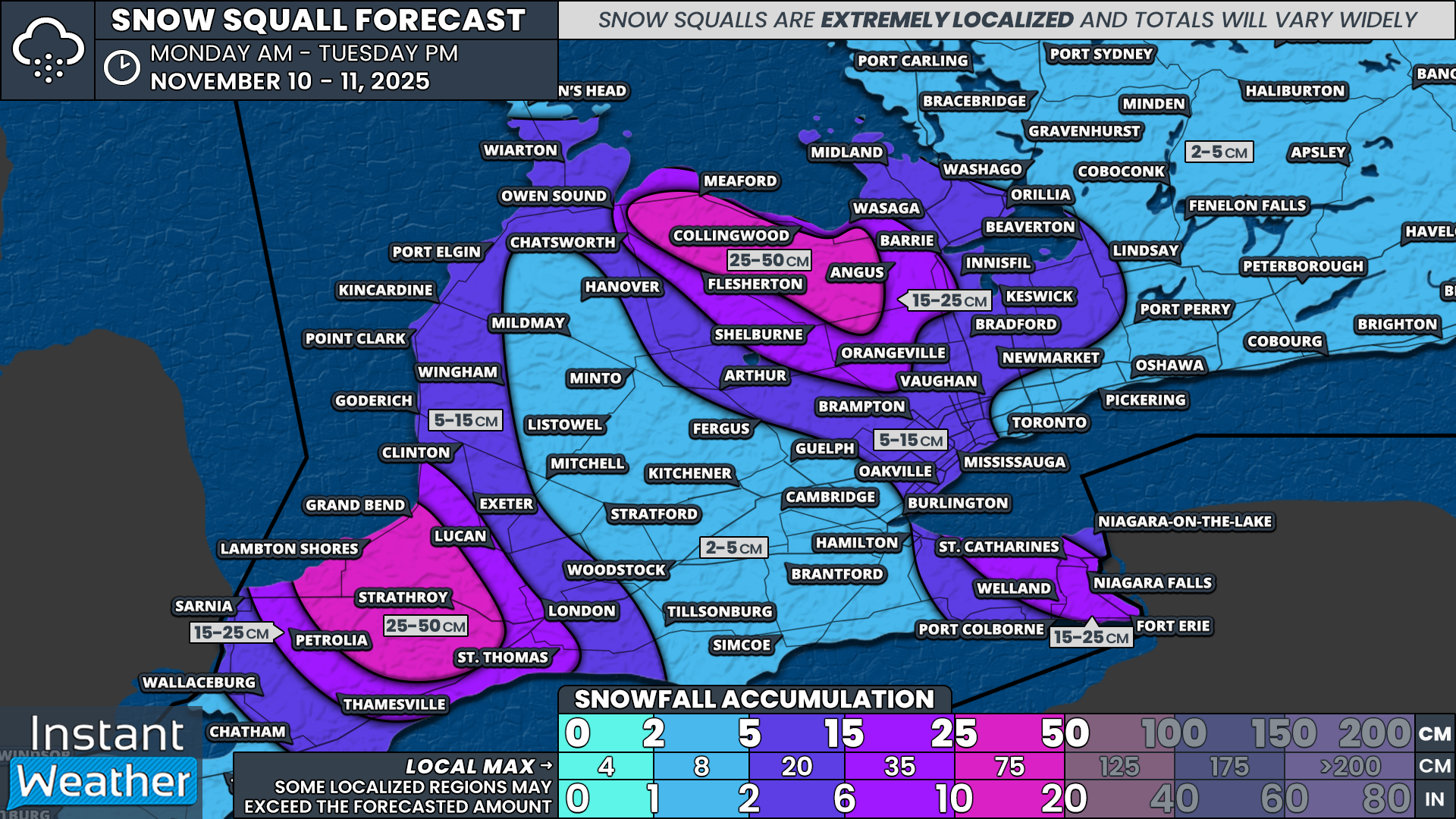
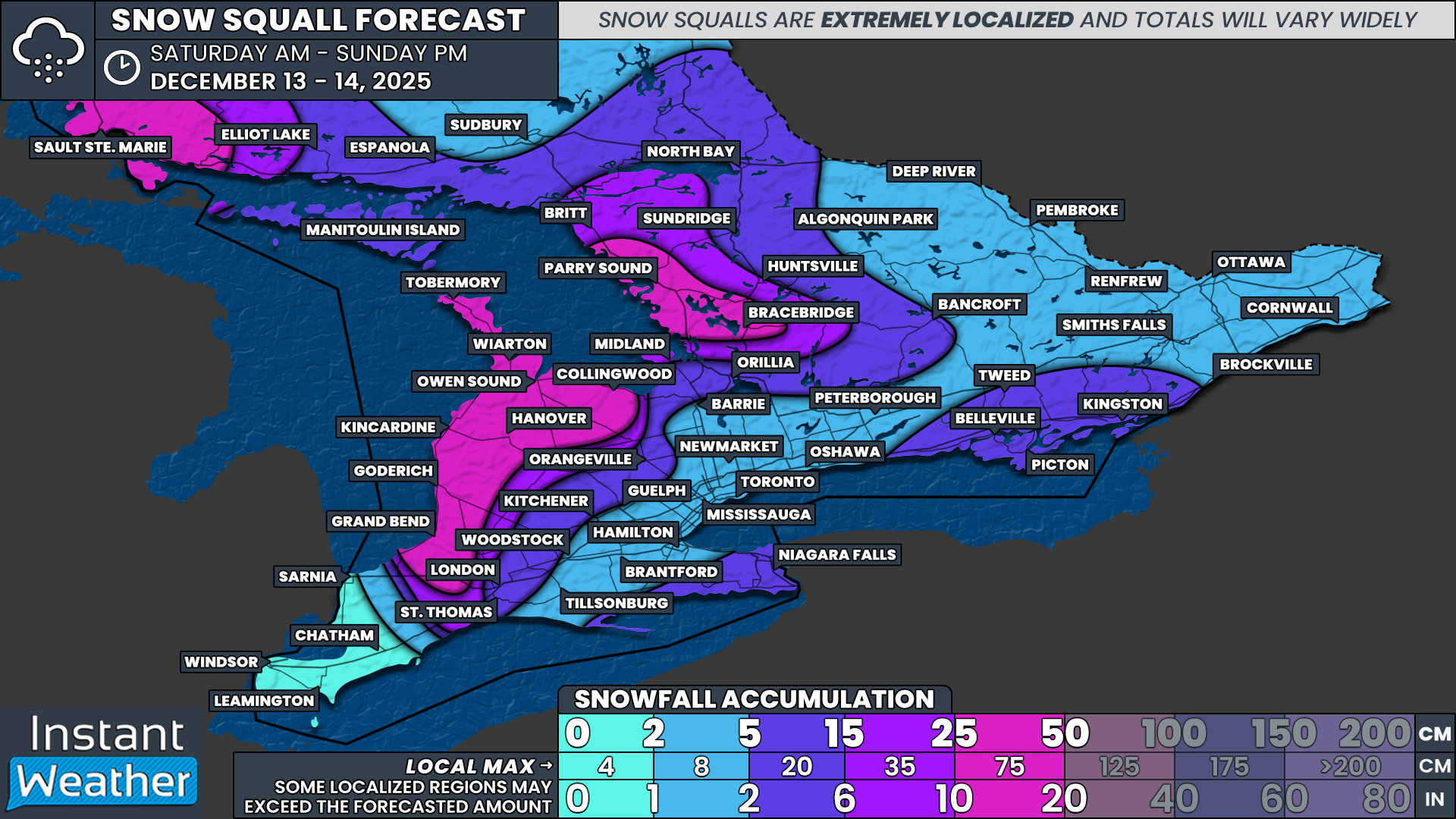
This lake effect activity is expected to continue through the overnight hours and into Monday morning. Local snowfall totals may reach up to 15 cm in the most persistent bands. Environment Canada has issued a mix of snow squall watches and warnings for the areas most likely to be affected.
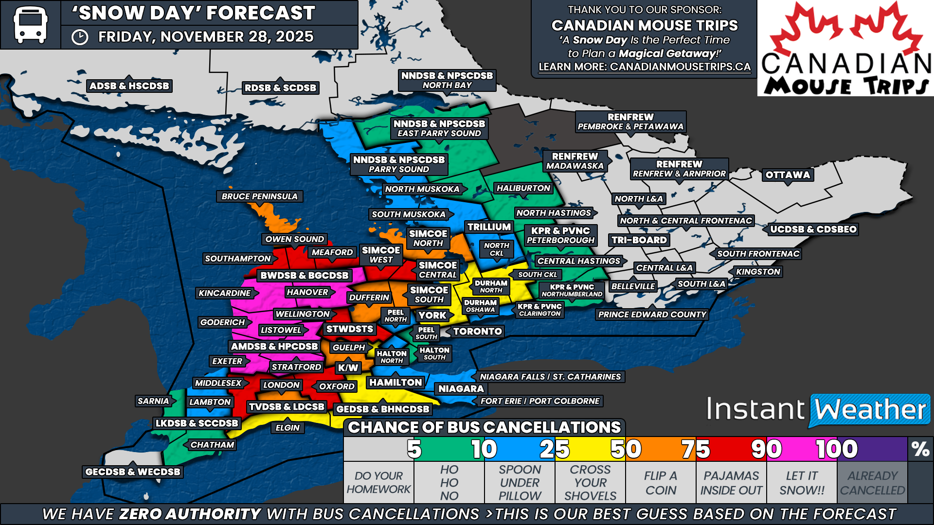
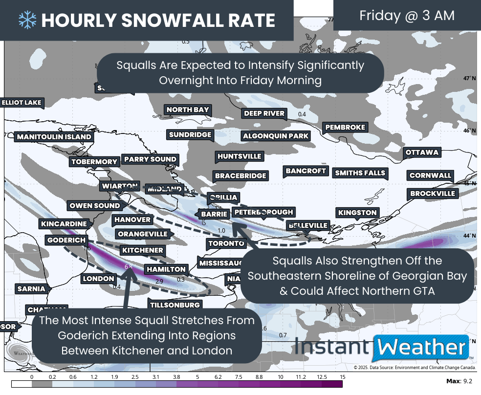
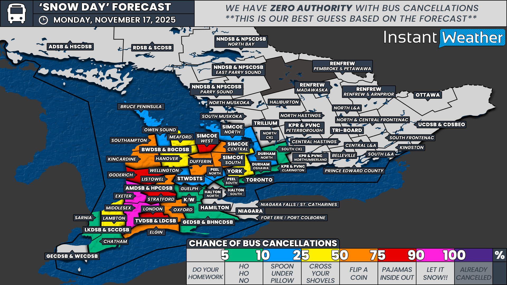
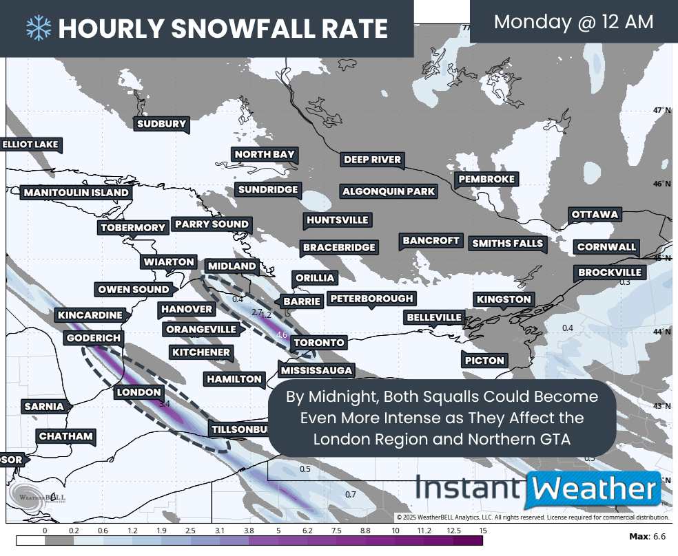
However, there is still quite a bit of uncertainty surrounding the exact intensity of these squalls and how long they will hold together. Because of this, we are not confident that conditions will reach the threshold needed to prompt widespread school bus cancellations. As a result, the highest probability on the map is capped at 50 percent along the southeastern shoreline of Lake Huron, where warnings are currently in effect and the most organized bands are expected to form.
This 50 percent zone includes southern Huron County within the Avon Maitland District School Board. It also extends into Middlesex County under the Thames Valley District School Board. These regions sit closest to the shoreline hotspot and stand the best chance of seeing stronger, more persistent squalls early Monday morning.
Surrounding this area, we have assigned a 25 percent chance for several boards that remain under a snow squall watch or tend to maintain a higher threshold for cancellations. This includes the London region of the Thames Valley District School Board and the west zone of the Simcoe County District School Board. We have also included northern Huron County and southern Perth County under the Avon Maitland District School Board, as well as the Kincardine, Southampton and Meaford regions within the Bluewater District School Board.
Temperatures are expected to fall quickly overnight, which may lead to icy and slick road conditions by the early morning commute. This is especially true in rural areas where backroads often remain snow-covered or untreated. Because of this, we have assigned a very low to low chance across rural portions of Central and Eastern Ontario. While cancellations are not expected, we cannot fully rule out a few isolated decisions if icy conditions become more impactful in rural areas.
Elsewhere across Southern Ontario, the chance of a snow day remains very low.
Disclaimer: Instant Weather has zero authority when it comes to bus and school closures.
It is completely up to the school boards, bus companies, local authorities, and parents to decide what is best for their children. This is our best guess based on our forecast.