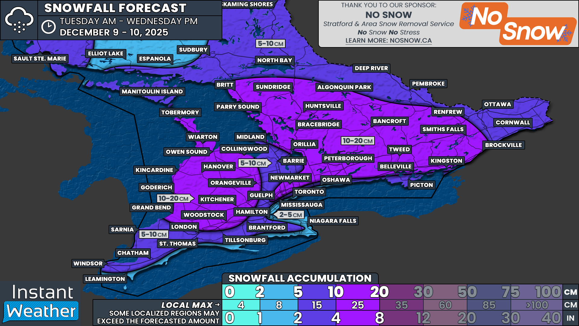
Back-to-Back Clippers To Deliver Up to 20cm of Snow Across Southern Ontario by Wednesday
/
NOTE: YOU CAN CLICK ON THE MAP TO OPEN A ZOOMABLE IMAGE
It has certainly been feeling a lot like winter over the last few weeks across Southern Ontario as the snow continues to pile up. Several clippers and rounds of lake effect snow have already delivered a healthy start to the season.
That trend shows no signs of slowing down as we enter the second week of December.
An Alberta clipper duo is set to slide through Southern Ontario back-to-back over the coming days. The second clipper arriving on Wednesday is expected to be the stronger of the two. Current indications suggest heavy snow combined with strong wind gusts may heavily impact the Wednesday morning commute.
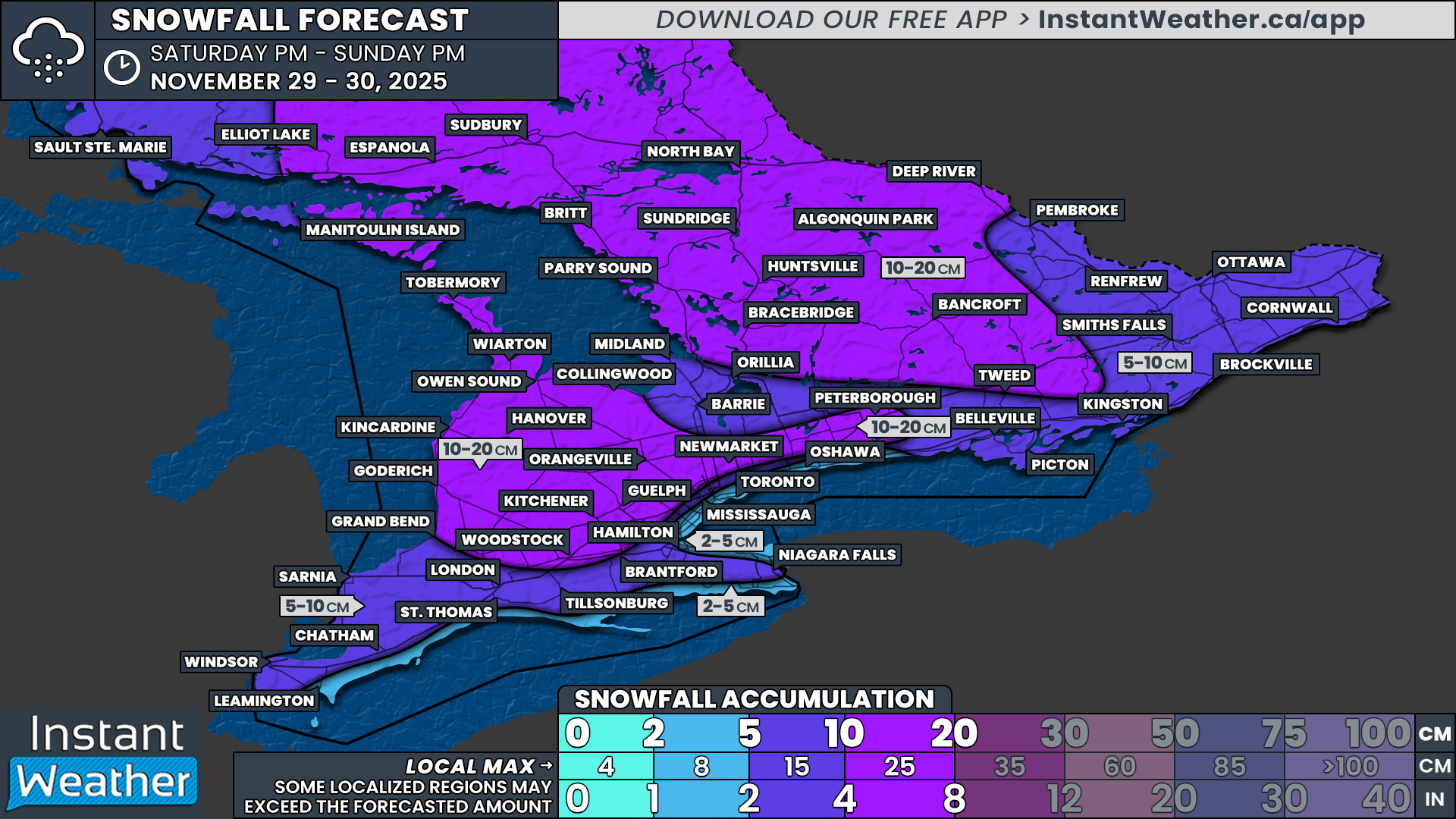
By the time the second clipper wraps up late Wednesday, combined snowfall totals are expected to range from 10 to 20cm across a wide swath of Central, Eastern and Southwestern Ontario. Localized totals up to 25cm cannot be ruled out, especially if there is some lake enhancement.
Lower totals are expected along the Lake Ontario and Lake Erie shorelines where temperatures may climb just enough for some rain to mix in later Wednesday morning. Around 4 to 8cm is possible for Deep Southwestern Ontario and the Golden Horseshoe.
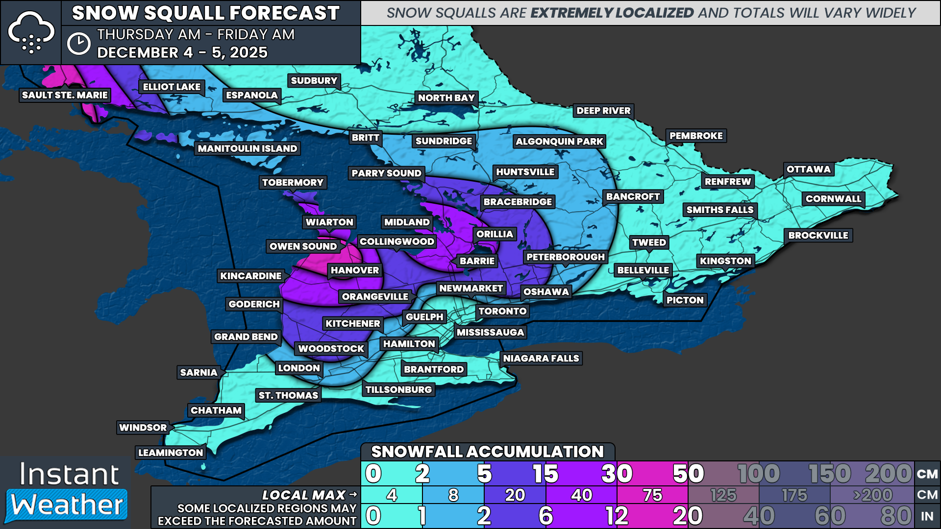
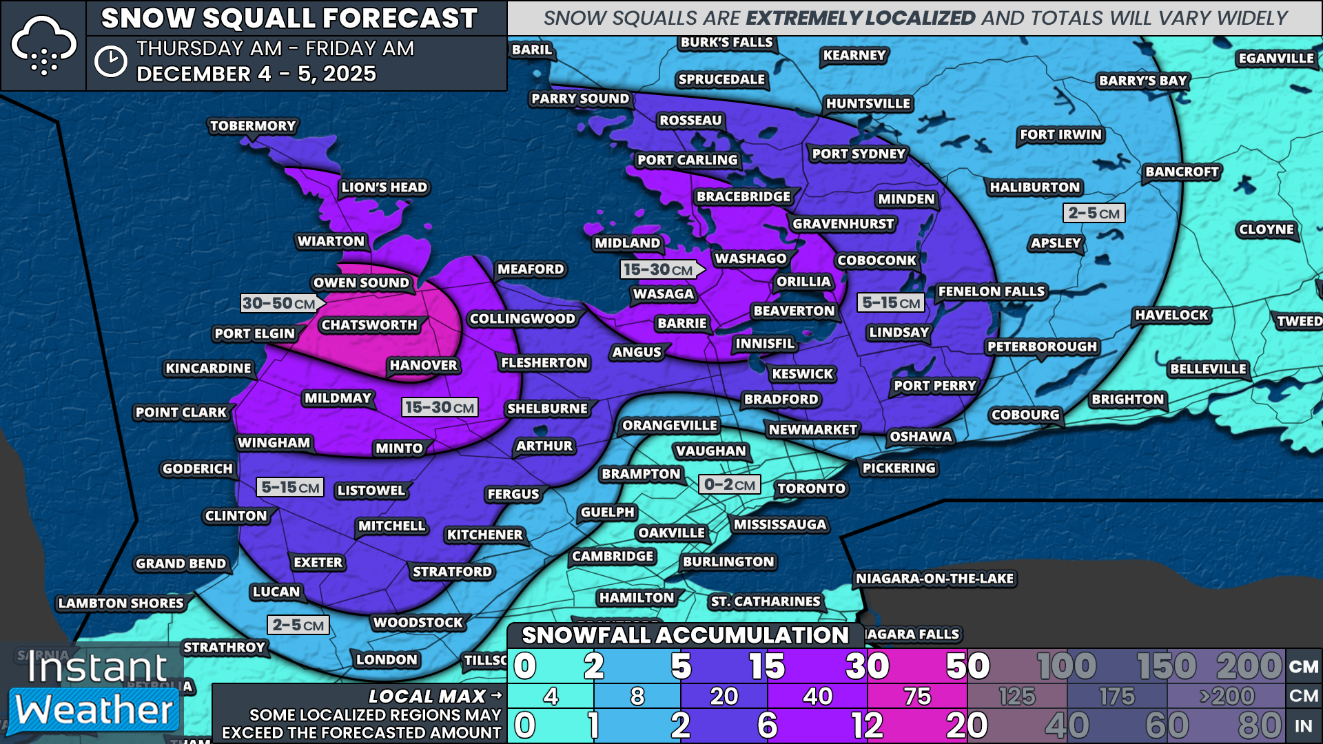
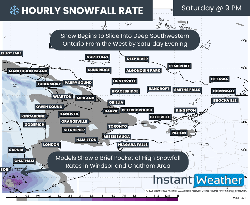
In the wake of the clippers, we are also monitoring a potential prolonged snow squall risk beginning Wednesday evening and potentially continuing through the rest of the week and into the weekend. Snowbelt regions around Lake Huron and Georgian Bay could be dealing with significant snowfall totals. There is still uncertainty regarding the exact placement of these bands.
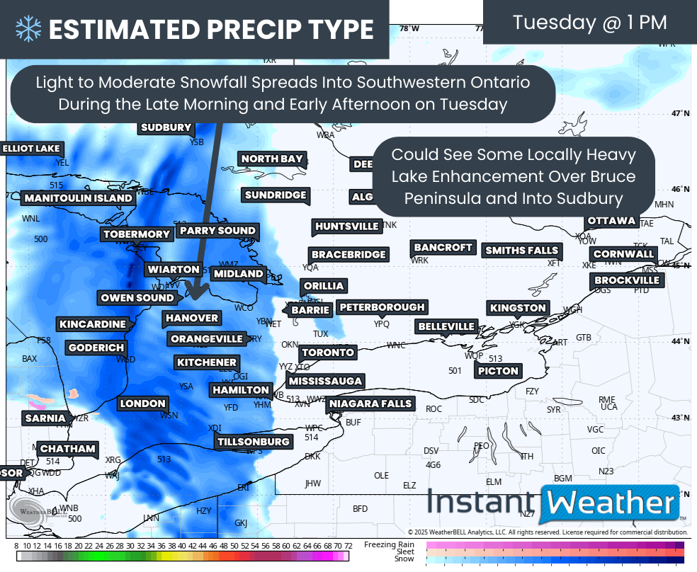
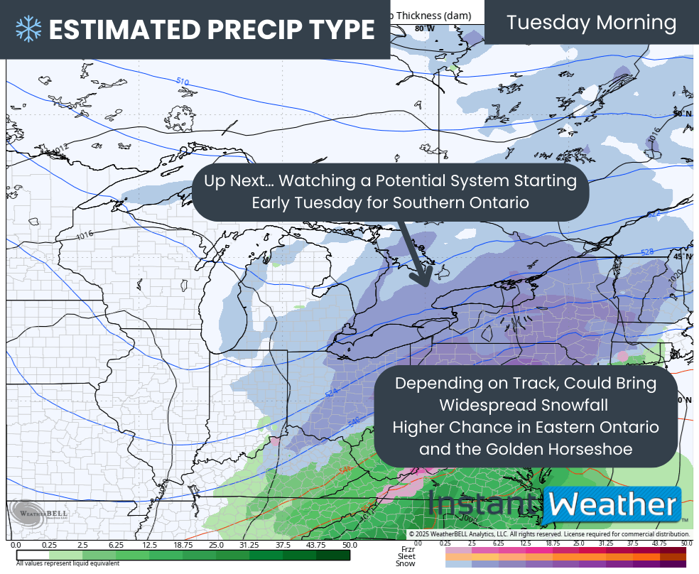
PRECIP TYPE - MAP FROM WEATHERBELL
Things will begin to kick off late Tuesday morning into early Tuesday afternoon as precipitation from our first clipper enters from the west. Widespread light to moderate snow will spread across Southwestern Ontario, the Lake Huron shoreline and into portions of Central Ontario and the GTA.
This snow is not expected to be particularly intense, although locally heavier pockets are possible through the Bruce Peninsula and into Sudbury where lake enhancement may add extra moisture to an otherwise dry system.
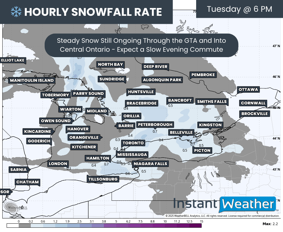
Hourly snowfall rates (cm) - MAP FROM WEATHERBELL
Steady snow will continue throughout the afternoon on Tuesday and into the evening. The story with this first clipper will be the steadiness of the snowfall rather than the intensity. Major routes should remain drivable, but expect a slower evening commute with light snow ongoing at the time.
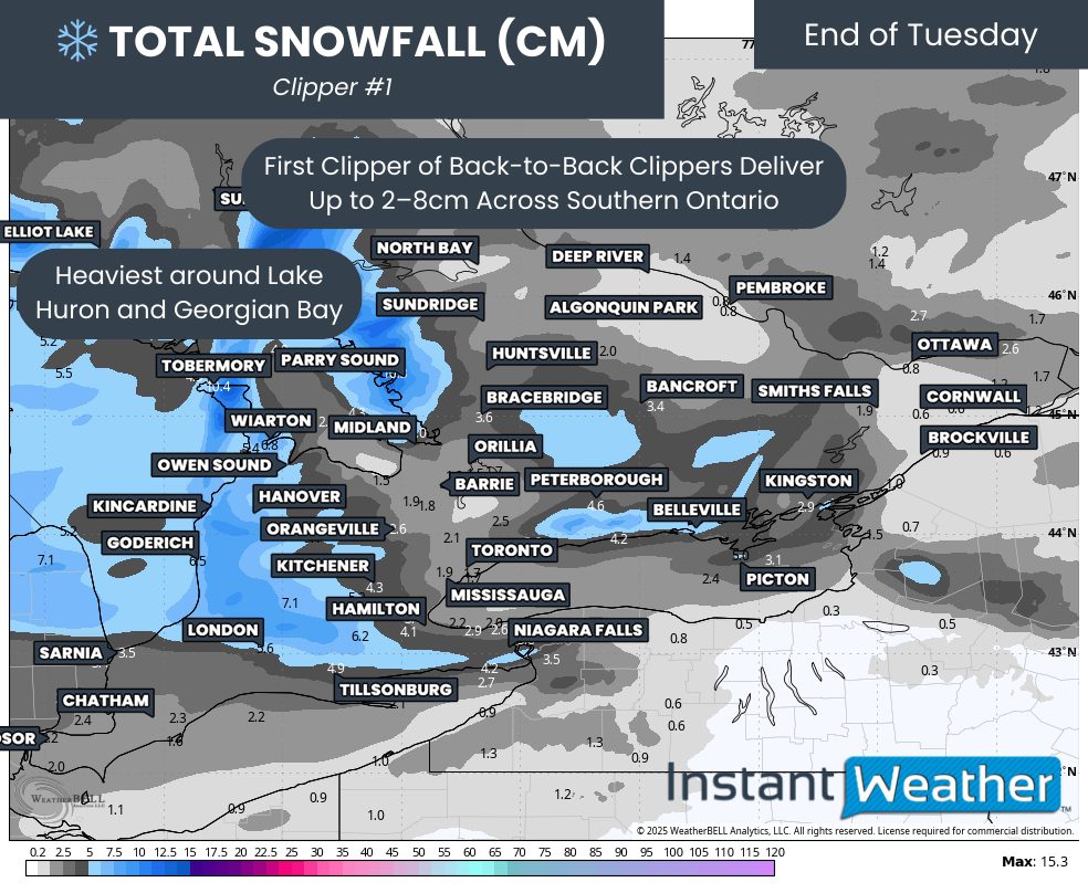
TOTAL SNOWFALL (CM) FROM CLIPPER #1 - MAP FROM WEATHERBELL
This clipper will begin to wind down later in the day on Tuesday with final amounts ranging from 2 to 8cm. The heaviest pockets will be east of Lake Huron and Georgian Bay. For the rest of Southern Ontario, accumulation will fall on the lower end of that range.
PRECIP TYPE - MAP FROM WEATHERBELL
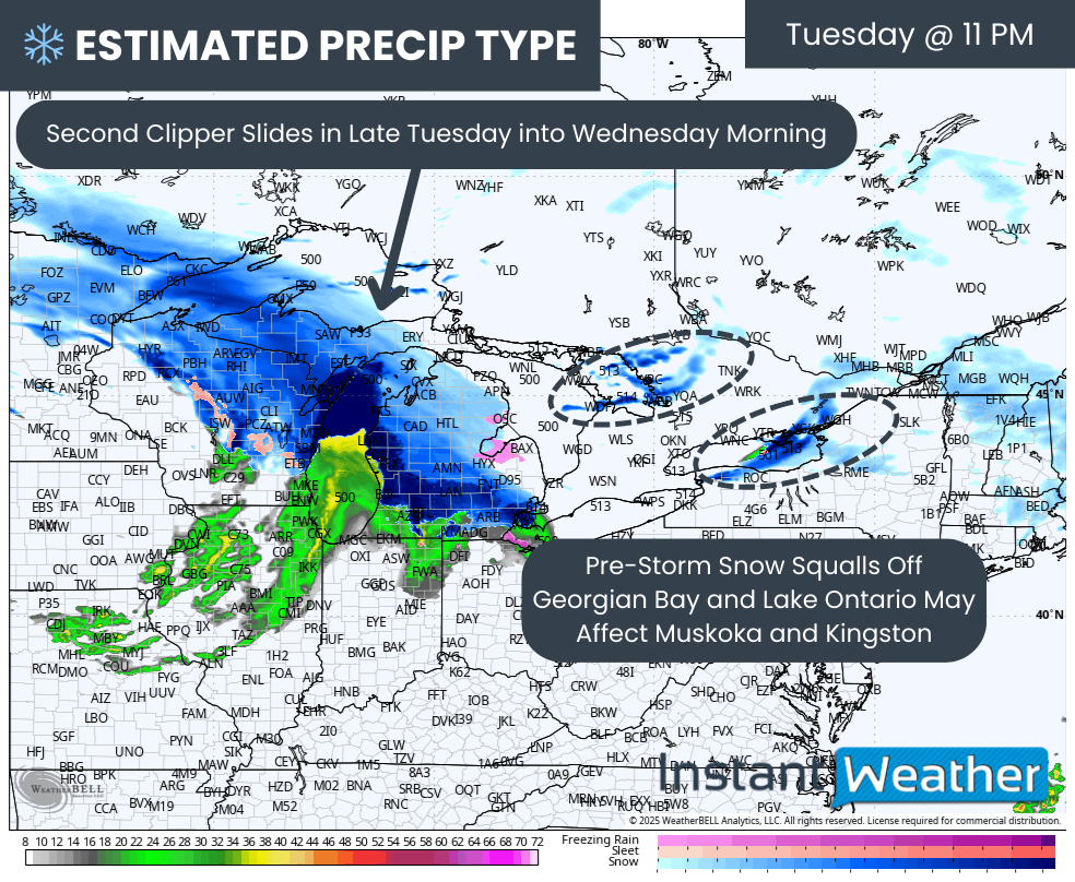
However, do not let the lower totals by Tuesday evening lead you to let your guard down. Our next clipper is not far behind and will track toward Southern Ontario from the Midwest by late Tuesday evening.
Ahead of it, we may see a few hours of heavy snow squalls develop northeast of Georgian Bay and Lake Ontario. This could bring brief but heavy snow to areas like Parry Sound, Muskoka and Kingston.
PRECIP TYPE - MAP FROM WEATHERBELL
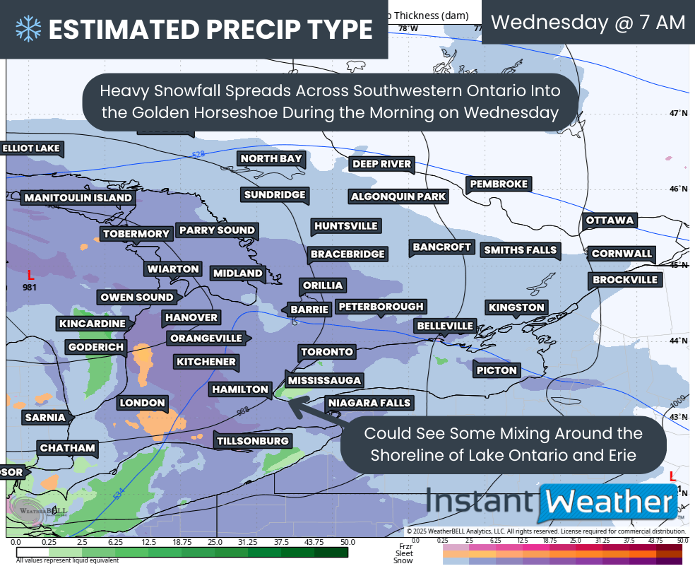
Conditions will really begin to deteriorate with the second clipper as the bulk of the precipitation spreads into Southwestern Ontario and the Golden Horseshoe right at the height of the Wednesday morning commute.
Some wet snow or even rain may mix in along the Lake Ontario and Erie shorelines which could suppress totals around the GTA and Niagara region.
Hourly snowfall rates (cm) - MAP FROM WEATHERBELL
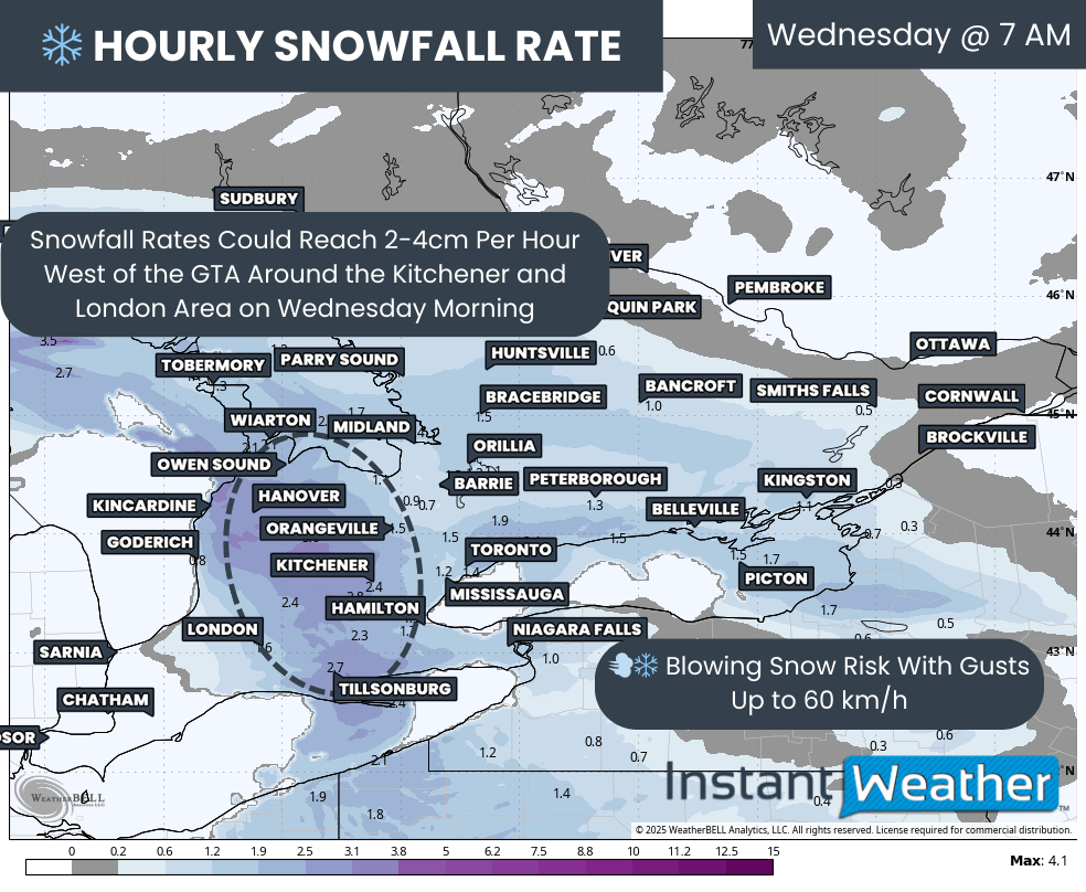
The key difference with this clipper compared to the one 24 hours earlier is that the snowfall will arrive in a much shorter window instead of being spread throughout the day.
Hourly snowfall rates may reach 2 to 4cm through the London to Kitchener corridor. While the intense snow will not last long, just a few hours of that kind of snowfall can add up fast.
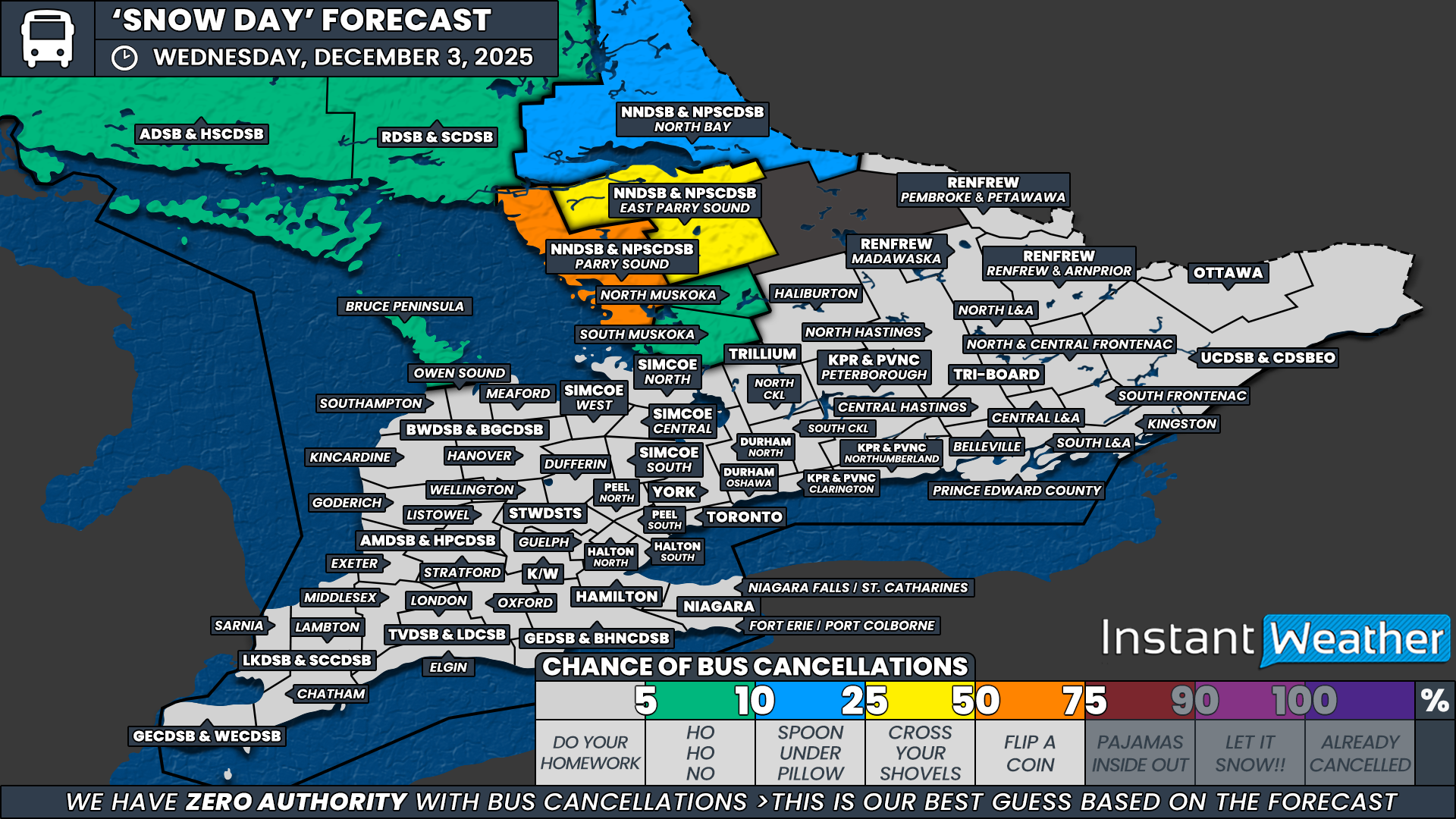
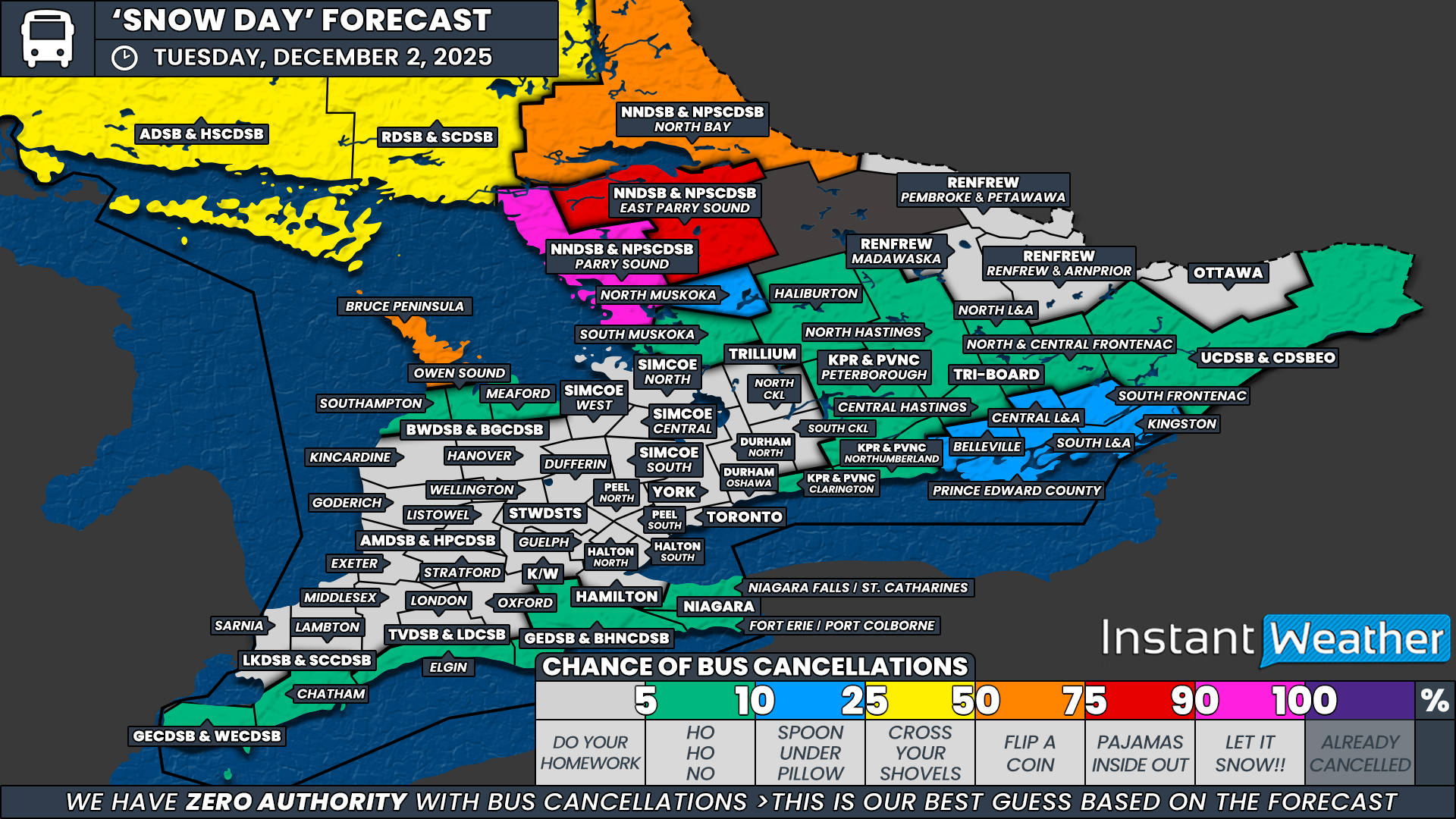
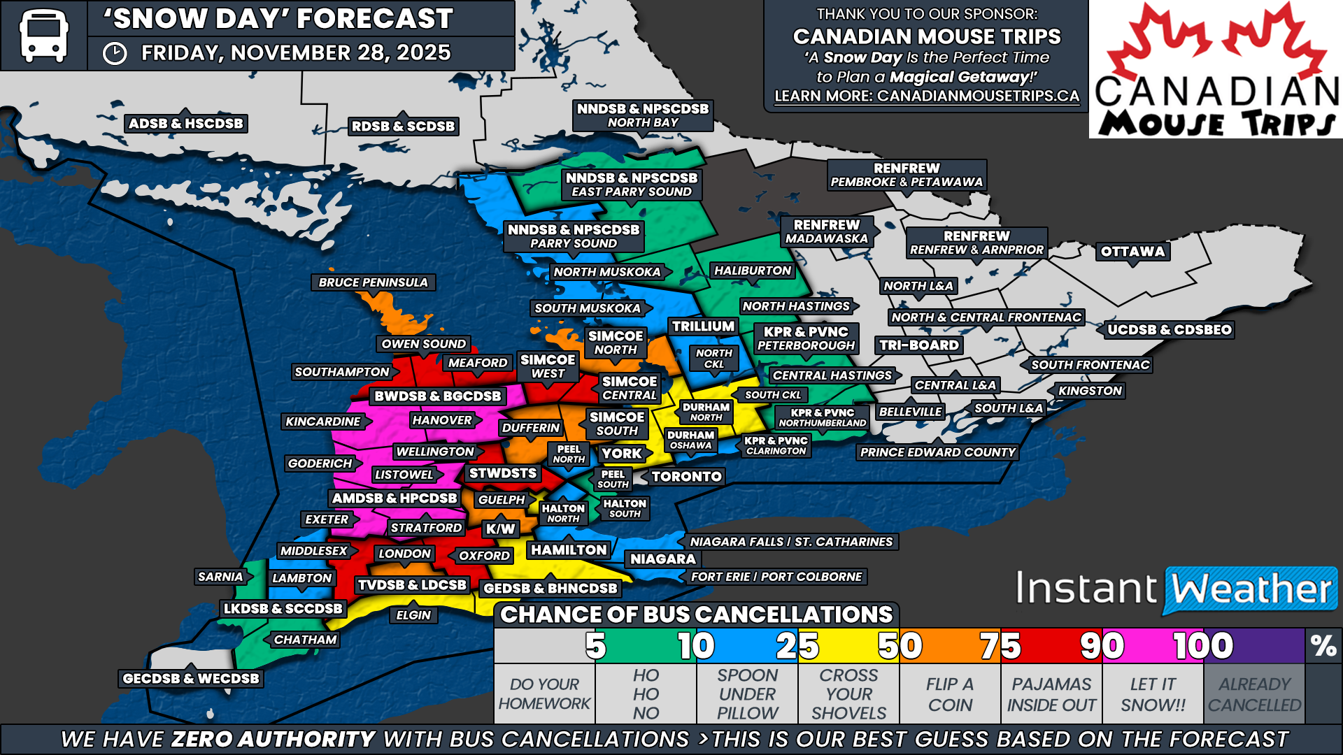
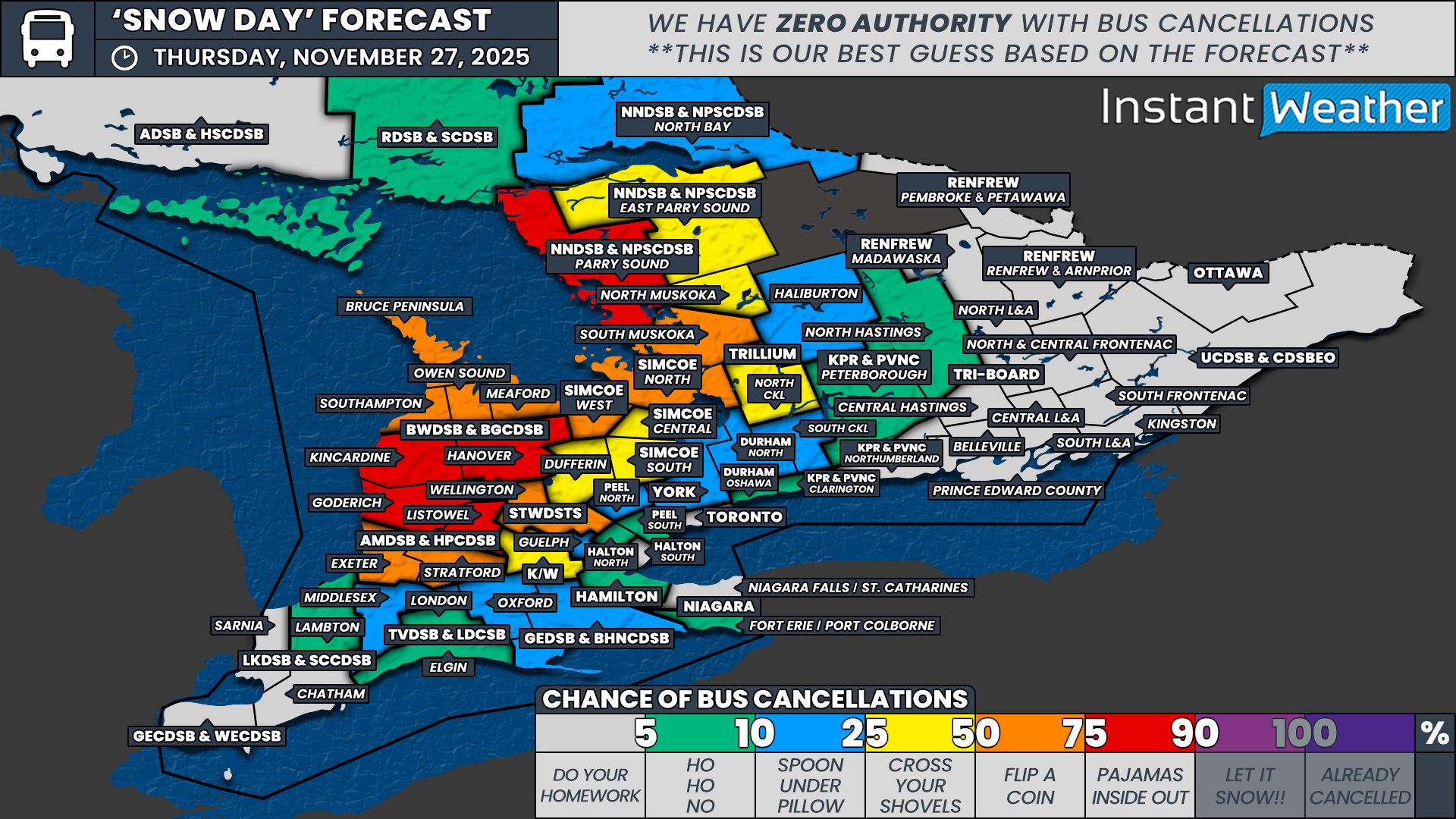
Winds are also expected to gust up to 60 km/h which combined with heavy snowfall could produce blowing snow and significantly reduced visibility. The morning commute is likely to be heavily impacted and school bus cancellations are quite possible on Wednesday.

Hourly snowfall rates (cm) - MAP FROM WEATHERBELL
The heaviest snowfall rates will not last long for Southwestern Ontario and the GTA as the 1+cm per hour rates shift into Central and Eastern Ontario by late morning.
Temperatures will also rise through the late morning and early afternoon which may allow some rain to mix in around the GTA and the Lake Erie shoreline.
PRECIP TYPE - MAP FROM WEATHERBELL
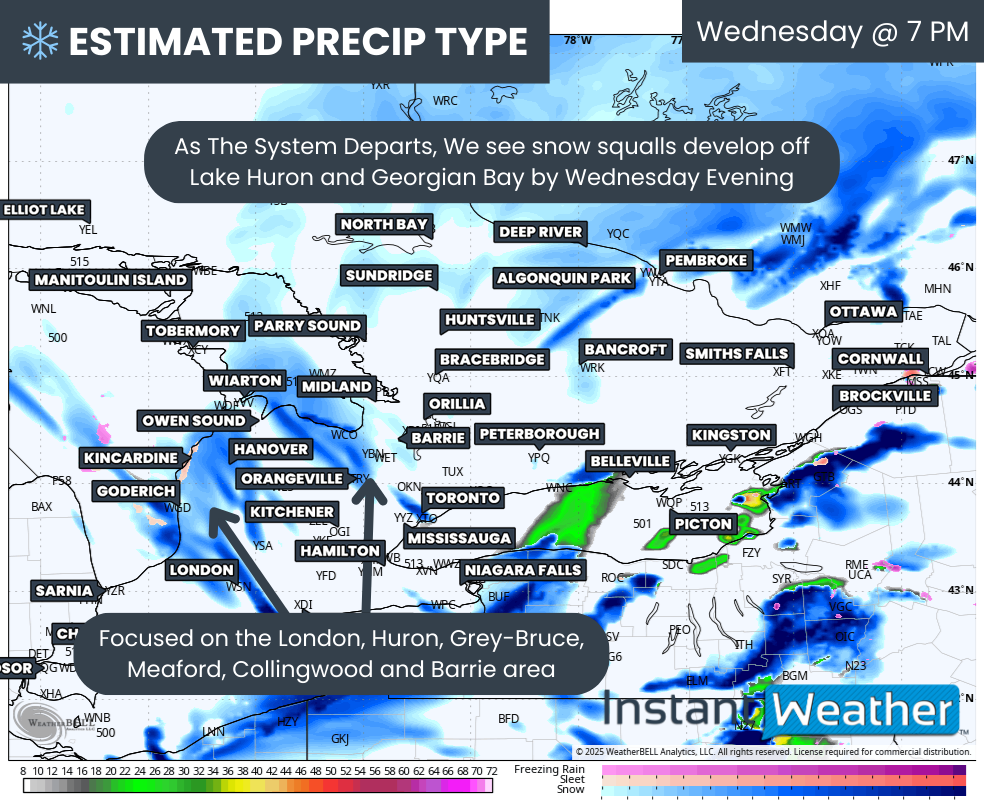
And yet, that is only the beginning because as the second clipper exits the region late Wednesday, the lake effect snow machine is expected to fire back up quickly by Wednesday evening.
Current data shows a focus on the London, Huron, Grey-Bruce, Collingwood and Barrie areas Wednesday night. The lake effect risk may carry into Thursday and possibly into the weekend as very cold air settles across Southern Ontario.
It remains unclear whether the wind direction will become stable enough to allow long-lasting snow squalls, but if it does, we could be looking at staggering snowfall totals by next week.
We will have a more precise breakdown of the snow squall risk closer to Thursday once high resolution model data is available to pinpoint where the bands may focus.
NOTE: YOU CAN CLICK ON THE MAP TO OPEN A ZOOMABLE IMAGE

Turning back to the combined snowfall totals from the two clippers, we expect a wide zone stretching across much of Central and Eastern Ontario and into Southwestern Ontario east of Lake Huron to end up around 10 to 20cm. There is potential for over-performance as some recent models have trended upward showing widespread 20 to 25cm. As clippers can sometimes struggle with moisture, we have undercut that slightly to better reflect the consensus.
One area where that moisture struggle may occur is southeast of Georgian Bay, including Barrie and York Region. Models show slightly lower totals of 6 to 8cm here, so we have placed those regions in a 5 to 10cm range. This 5 to 10cm zone also extends along the Hwy 401 corridor into Deep Southwestern Ontario and into the Ottawa region.
For regions directly along the Lake Ontario and Erie shorelines like Toronto, Mississauga, Oakville, Burlington, Hamilton and St Catharines, snowfall may struggle to reach 5cm due to mixing potential and above freezing temperatures limiting accumulation.
Keep in mind that these are combined snowfall totals from both systems. Roughly 50-75 percent of the total will likely fall within a 6 hour period on Wednesday which is when conditions will be at their worst.
Additional snowfall is possible later Wednesday into Thursday with snow squall activity. Those amounts are not included in this map. A separate forecast will be issued on Wednesday for that.