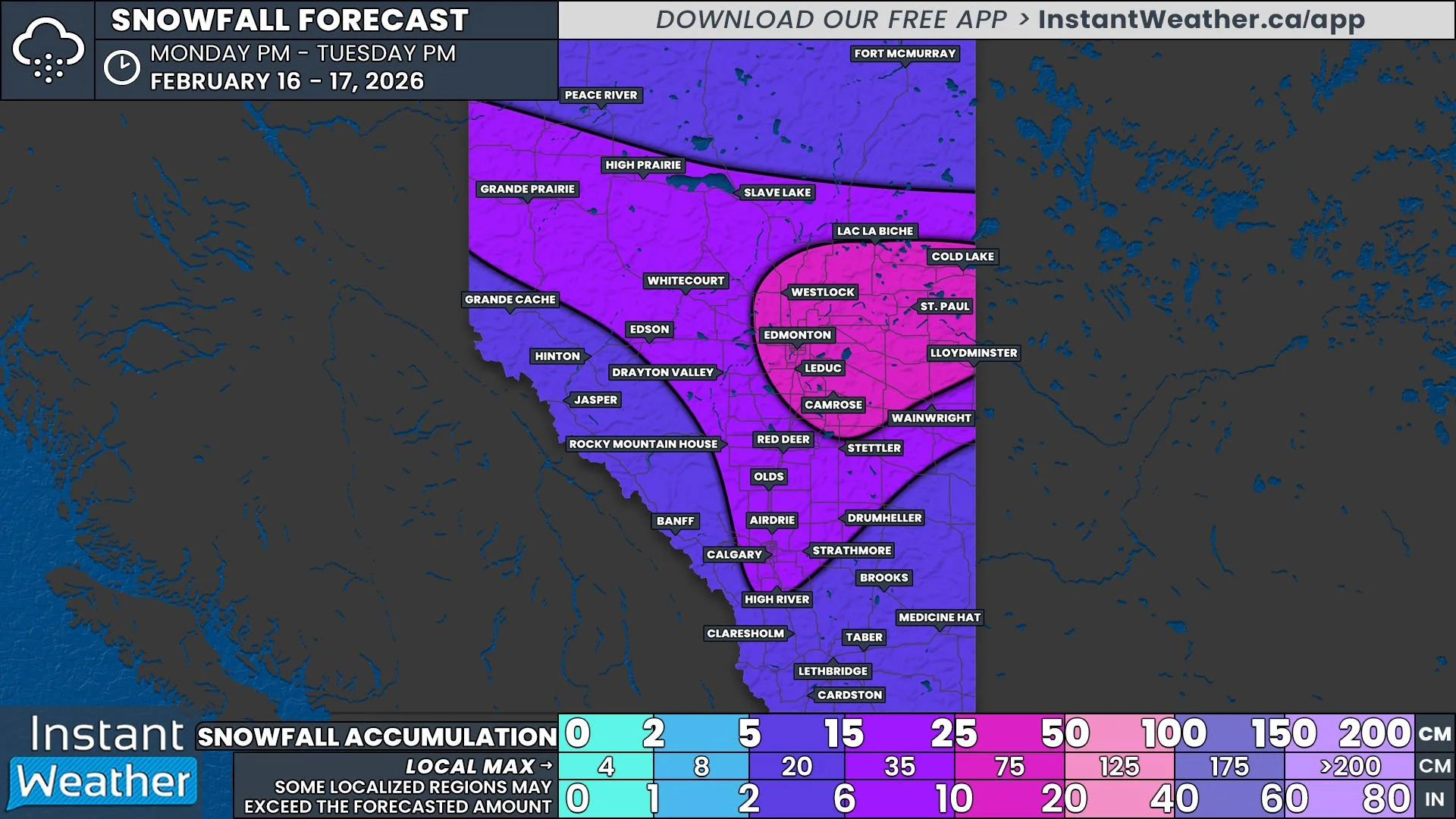
UPDATE: Slight Risk for Severe Thunderstorms for Friday Now Extends into Calgary
/
NOTE: YOU CAN CLICK ON THE MAP TO OPEN A ZOOMABLE IMAGE
In an update to the forecast that was posted yesterday evening, we have extended the boundaries of the Slight Risk region to include Calgary and the entire Highway 2 corridor south of the city. The combination of damaging wind gusts, large hail, and the possibility of an isolated tornado from today’s has resulted in the Slight Risk for this area, along with Lethbridge, Medicine Hat, and Drumheller.
Thunderstorms have already begun to develop in Montana, moving northward towards the border. They will start to cross into Alberta later this afternoon and early evening, spreading across Southern Alberta throughout the rest of the evening and overnight. It’s possible that the storms could become organized into a line that will push northeastward starting later in the evening which will impact a more widespread area than just isolated storms.

The main threat from these storms will be the hail, with up to toonie to timbit-size likely, as well as damaging wind gusts that could exceed 100km/h and even approach 130km/h. At this time, there does not appear to be too much of a flooding risk, with these storms expected to bring less than 50mm of rain over the span of a few hours. An isolated tornado can also not be completely ruled out.