Elevated Severe Thunderstorm Risk in Parts of Southern Ontario on Monday
/

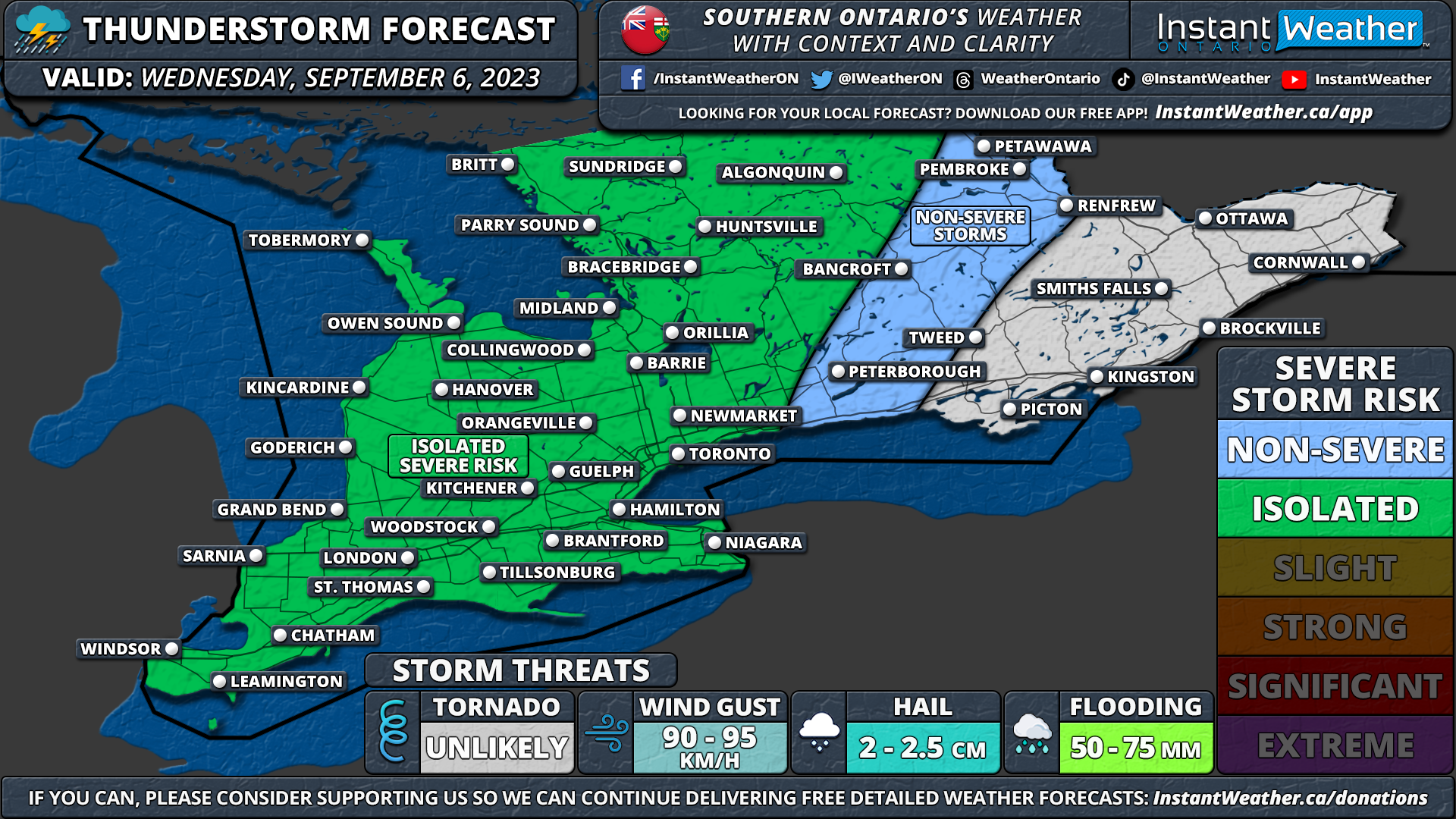
NOTE: YOU CAN CLICK ON THE MAP TO OPEN A ZOOMABLE IMAGE
After a damp and somewhat chilly weekend across Southern Ontario, the heat has returned to kick off the week. Many areas in Southwestern Ontario, extending into the Golden Horseshoe and Central Ontario, are expecting daytime highs in the mid-20s on Monday. There's even a slight chance that those in Deep Southwestern Ontario, including Windsor and Chatham, could hit 30°C for the first time this year!
However, this heat will also provide the fuel for some thunderstorm activity during the afternoon and evening hours. Some of these storms have the potential to become severe, with the main threat being large hail up to the size of toonies or ping-pong balls. Marginally severe wind gusts around 90 km/h are also possible, and an isolated tornado cannot be ruled out.
The threat for severe weather stretches from the Lake Huron shoreline, eastward through the Greater Toronto Area and around the Lake Simcoe area. There could also be some severe storms in Eastern Ontario, especially around the Peterborough, Bancroft, and Tweed regions.
We expect storms will begin to fire sometime between 3 to 6 PM along a line extending from Lake Huron to Bancroft. Keep in mind that these cells will be extremely localized, and most areas may not even see a storm today. However, based on the expected environment, any storms that develop will have the potential to quickly become severe and will likely start producing severe hail, which is the main concern with these pulse-like storms.

Current indications suggest two main clusters of storms will develop, with the first cluster located over Lake Huron and tracking through Huron, Grey, Bruce, Dufferin, and Wellington counties. The other cluster will be located around Kawartha Lake, Halliburton, Peterborough, and Bancroft. These storms will likely weaken as they track further into Eastern Ontario where the environment is less favorable to support severe weather.
By the early evening hours, the cluster of storms east of Lake Huron will continue to mature with all severe threats on the table including very large hail, strong wind gusts, and maybe even an isolated tornado. They are expected to track into Simcoe County and York Region around Lake Simcoe by 6 to 8 PM.
By the mid to late evening, daylight will begin to fade, reducing the daylight heating that is fueling these storms. They are expected to track into Central Ontario, including Kawartha Lakes and Halliburton, as they gradually weaken once nightfall occurs. We could still see some small hail and strong wind gusts with these storms throughout Eastern Ontario until around midnight.
Non-severe thunderstorms are expected to continue along that same corridor throughout the overnight hours. While we don’t expect any severe threats overnight, flooding could become an issue as multiple rounds of storms train over a particular region.